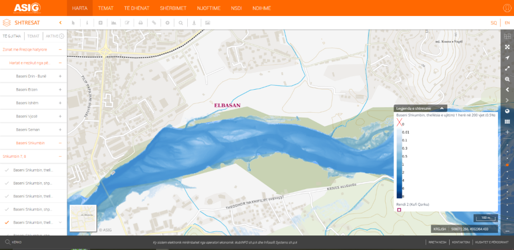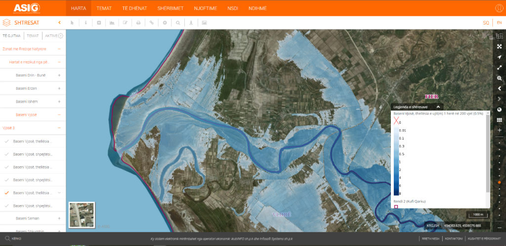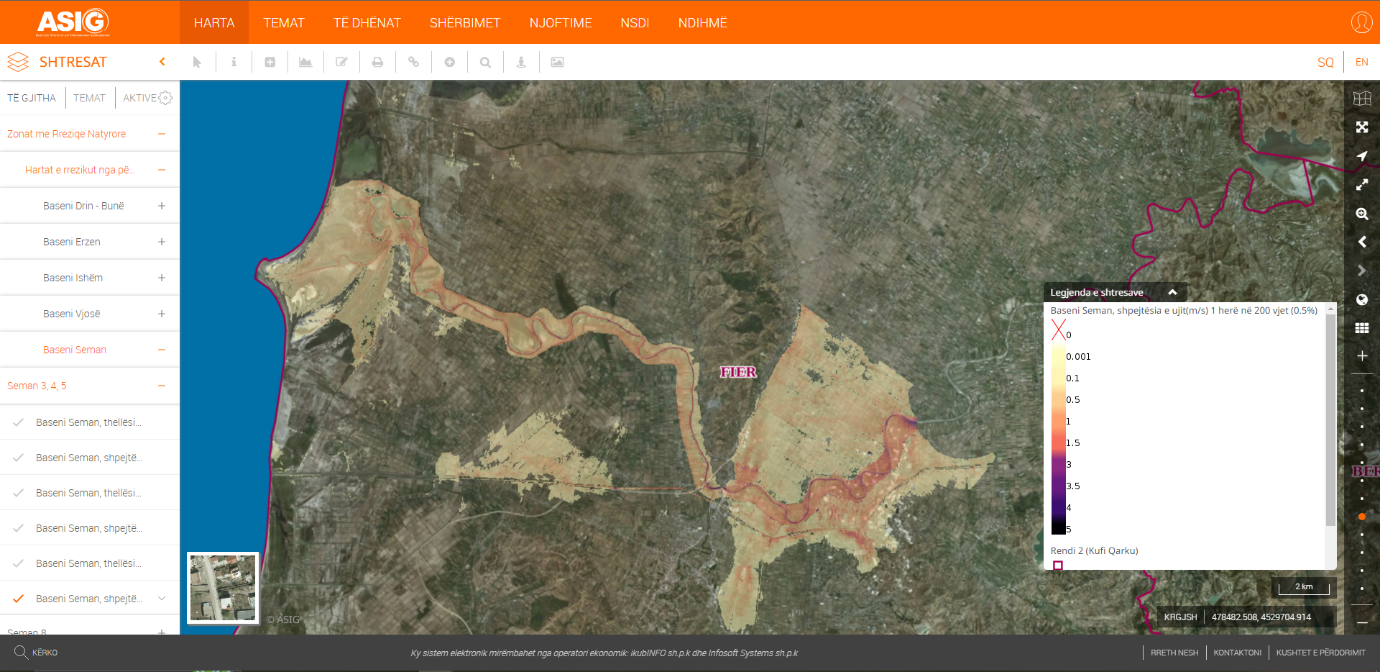
State Authority for Geospatial Information (ASIG) in cooperation with the Water Resources Management Agency (AMBU) has published on the National Geoportal on the topic “Areas with natural risks”, the geospatial information for Flood Risk Maps for the 6 main basins.
The geospatial information for these layers is in line with the EU Flood Directive, which presents a risk map for the area as well as for the specific return period, depth and velocity.
The data are in accordance with the standard approved by VKM no. 810, dated 21.10.2020, For the approval of the document “State Standards for Technical Specifications of Geospatial Information in Albania – Topic: “Natural Risk Zone”.