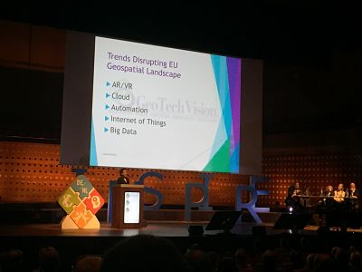
Participation in the INSPIRE 2018 conference
Representatives of the State Authority for Geospatial Information (ASIG) attended the INSPIRE 2018 “Inspire Users: Make It Work together” conference, held on 18-21 September 2018 in Antwerp, Belgium, under the auspices of the European Commission, the Netherlands and Belgium. In this conference were invited to participate the main contributors in the implementation of EU Directive 2007/2 / EC “INSPIRE” as well as private providers of digital technologies.
The conference addressed important issues of geoinformation among which:
•Using the INSPIRE mechanism to address the emerging digital transformation and information displayed and new ones challenges, for a more sustainable governance in a rapidly evolving environment of information society.
• The need for better co-operation and co-ordination among stakeholders directly involved in the design and implementation of relevant global initiatives in the field of geoinformation.
• Exchange of views on solving problems and technical difficulties encountered in implementing and using INSPIRE.
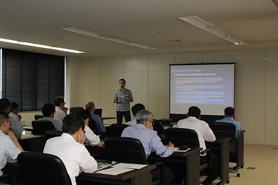
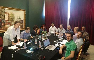
Presentation at the workshop on the theme: “Building Capacity in Higher Education, BESTSDI Project”
In the premises of the Faculty of Civil Engineering, a workshop is taking place with the theme: “Capacity Building in Higher Education, BESTSDI Project”.
On the first day of this workshop, the General Director of ASIG, Mr. Lorenc Çala, delivered a presentation on the role, responsibilities, and achievements of ASIG in establishing the National Spatial Data Infrastructure (NSDI) in the Republic of Albania.
The presentation highlighted the need to increase the capacities of professionals in the geoinformation field, the role of university curricula in this direction, and the need to align it with rapid technological developments.
The BESTSDI project (Evolution of academic education in Western Balkans and continuous professional training for geospatial information infrastructure) is undertaken under the Erasmus+ program to support higher education and capacity building at internationally required levels for the implementation of the European Directive 2007/2/EC “INSPIRE.”
The direct contribution of this workshop is the modification and improvement of university curricula to prepare professionals who will create and use geospatial information in accordance with European standards.
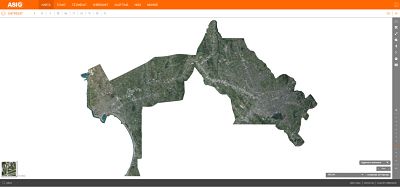
ASIG PUBLISHED ORTHOPHOTO 2018 FOR THE AREA TIRANE-DURRES
Through the project “Geospatial Information on the Sustainable Development of the Territory in the High Intensity Area of Tirana-Durres Development”, funded by the Japanese Agency for International Cooperation (JICA),was conducted air photography and the production of orthophotos with a resolution of 0.08 m / 375 km² including the economic triangle Tirana-Vora-Durres.
The project envisages the creation of large-scale digital maps for this area, according to contemporary methodologies and standards, used in Japan, as well as the transfer of technology, including hardware and software infrastructure, with a view to establishing, at a later stage of maps such for the entire territory of the country.
Large-scale maps, which have not been produced for more than 25 years, are very much needed for the country’s development, especially as regards property issues and infrastructure construction.
Ortofoto has already been published in the National Geoportal and you can access it on the link: https://geoportal.asig.gov.al/map/?fc_name=Ortofoto_2018&auto=true
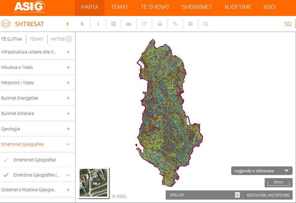
PUBLISHED ON THE NATIONAL GEOPORTAL GEOSPATIAL INFORMATION ON THE SUBJECT “GEOGRAPHICAL NAMES”
ASIG, in the role of the responsible public authority, has created and published on the National Geoportal the geospatial information on the topic “Geographic Names”. The published information is in full compliance with the standard approved by VKM no. 142, dated 22.02.2017 “For the Approval of the Document State Standards for Technical Specifications of Geospatial Information in Albania – Topic: “Geographical Names”.
The published information contains three categories of data which are:
1.Official residences in the Republic of Albania (Towns-Villages). The total number of points processed for the entire territory of the Republic of Albania is 3056. The information collected and processed was taken from the maps of the Territorial Administrative Division of Local Government Units in the Republic of Albania of 2014.
2. Relief, the total number of processed points for the entire territory of the Republic of Albania is 9926. The information for this category is collected from topographic maps of scale 1:25 000, refined with maps of scale 1:10 000. Elements of relief are divided into several types and are presented in the attribute “LlojiLokal” such as: field, field, tail, bank, rib, bunishte, chuka, face, field, pit, mouth, stone, hauz, shadow, island, etc.
3.Hydrography – the total number of processed points for the entire territory of the Republic of Albania is 5157. The elements of this category are of several types and are presented in the attribute “Local Type” such as: stream, lake, catchment, reservoir, river, channel, etc. The published information is very important and helps the users of the National Geoportal, public institutions, business and citizens and combined with the information on other geoinformation topics creates an added value of the National Geospatial Information Infrastructure in Albania.
Për më shumë informacion mund të klikoni në linkun:
https://geoportal.asig.gov.al/map/?fc_name=egj_total_krgjsh_asig&auto=true
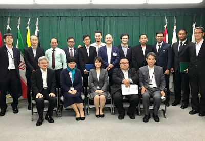
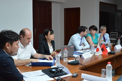
Participation in the training organized by the Japan International Cooperation Agency (JICA)
Representatives from the State Authority for Geospatial Information (ASIG) participated in a training conducted by the Japan International Cooperation Agency (JICA) from May 27 to July 7, 2018, in Japan, focusing on the “Management and Utilization of National Control Points for Geodetic Work Efficiency.”.
The training aimed to expand knowledge and enhance capacities in the management and utilization of the Albanian Geodetic Reference Frame. Its program was comprehensive, starting from basic knowledge of the administrative system and geodetic activities in Japan to in-depth theoretical and practical knowledge about GNSS systems, CORS, gravimetry, etc.
In addition to the above knowledge, ASIG participants, Mr. Arian Lasku from the Sector of the National Geodetic Reference Frame, and Mr. Rudens Konomi from the CORS Systems Infrastructure Sector, conducted a study with the support of Japanese experts to solve and improve existing issues related to the Albanian Geodetic Reference Frame.
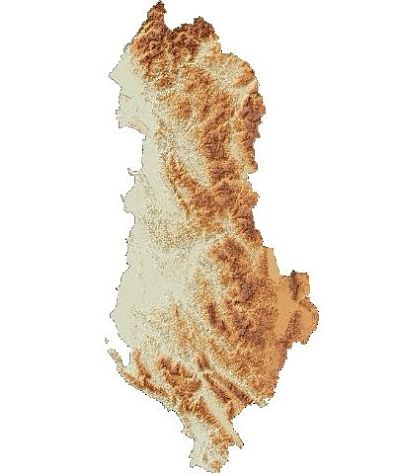
3D Digital Terrain Model is published
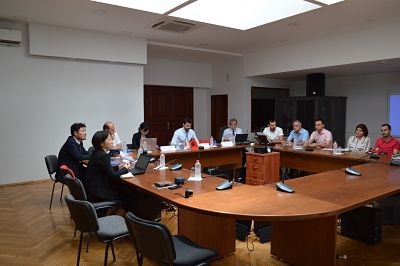
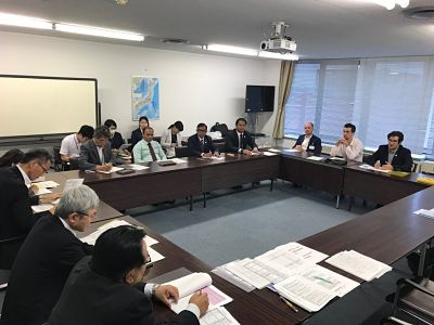
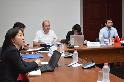
The first Coordination Committee meeting of the project between JICA and ASIG was held.
In the framework of cooperation for the implementation of the project “Geospatial Information for Sustainable Development of the Territory in the high development intensity area of Tirana-Durres,” the first Coordination Committee meeting was held on June 19, 2018, in the premises of the “Europa” hall, under the direction of the General Director of ASIG, Mr. Lorenc Çala.
In this meeting, attended by the working groups of JICA and ASIG, as well as the representative of the Prime Minister’s Office in the project steering committee, the current progress, the work plan for the upcoming months, and the issues arising during the project development were discussed.
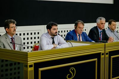
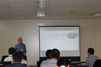
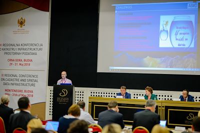
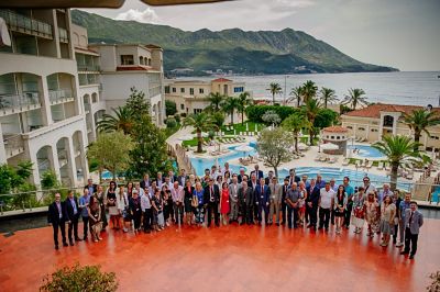
ASIG participates in the XI Regional Conference on Cadastre and Geospatial Data Infrastructure
At the XI Regional Cadastre and Infrastructure Information Conference held in Budva on May 30-31, 2018, with the invitation of the Real Estate Administration of Montenegro were also present representatives of the State Authority for Geospatial Information (ASIG) headed by the General Director, Lorenc Çala.
The topic of the conference was “The use of Geospatial Data in the Development of the Digital Society, Challenges and Perspectives” a topic that is very present both for our region, the Western Balkans and the rest of Europe.
At this conference, representatives of ASIG presented plans and vision for the future use of geospatial data, planned projects and the challenges that have been faced .
At the end of the Conference, was reached on the conclusion that is needed further growth and expansion of cooperation with international institutions and associations for the purpose of exchanging knowledge based on experience and standards, as well as direct support in the preparation and implementation of projects.
Institucionet pjesëmarrëse shprehën vlerësimin për donatorët dhe shoqatat ndërkombëtare si dhe besimin për bashkëpunim të mëtejshëm në të ardhmen.
Participation in the workshop on the topic: “Copernicus Land – Pan-European Component – CLC2018”
In the context of presenting new techniques for creating geospatial data for CORINE 2017-2018, a workshop titled “Copernicus Land – Pan-European Component – CLC2018” was held on May 22-23, 2018, at Hotel Diplomat 2 in Tirana. The workshop was organized by the National Agency for Environment (AKM), in collaboration with the European Environmental Agency (EEA).
ASIG was represented at this workshop by Mr. Mikel Millja, responsible for the Standards of Geoinformation sector, who, according to the agenda, delivered a presentation on the functions, purpose, and objectives of ASIG.
The collaboration between ASIG and AKM for the creation of the standard on the topic of Land Cover was highlighted during the workshop.
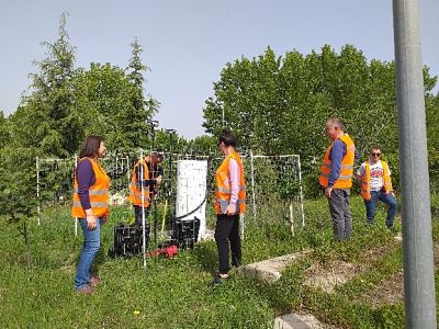
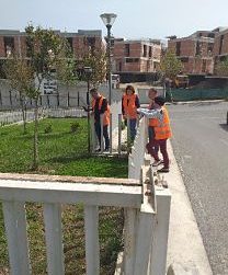
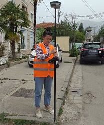
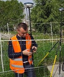
Creation of the base map for the Tirana-Durres area
Within the framework of the project with JICA (Japan International Cooperation Agency), the Cartography Sector at ASIG continues field inspections for the construction of the base map for the Tiranë-Durrës area.
Quality control of data for transportation elements obtained from 3D surveying has been tested. This includes field inspection and measurement of points, calculation of the coordinate differences (actual) measured with GPS and the coordinates obtained from 3D digitization.