CALL #7: NATIONAL INTERNSHIP PROGRAM.
The seventh call of the Program is an opportunity for all young people aged 21 to 26 who have completed at least the first cycle of “Bachelor” studies and have not been part of the program in previous calls.
The application is done on the online platform until July 31, 2022, at the following link:
https://praktika.riniafemijet.gov.al.
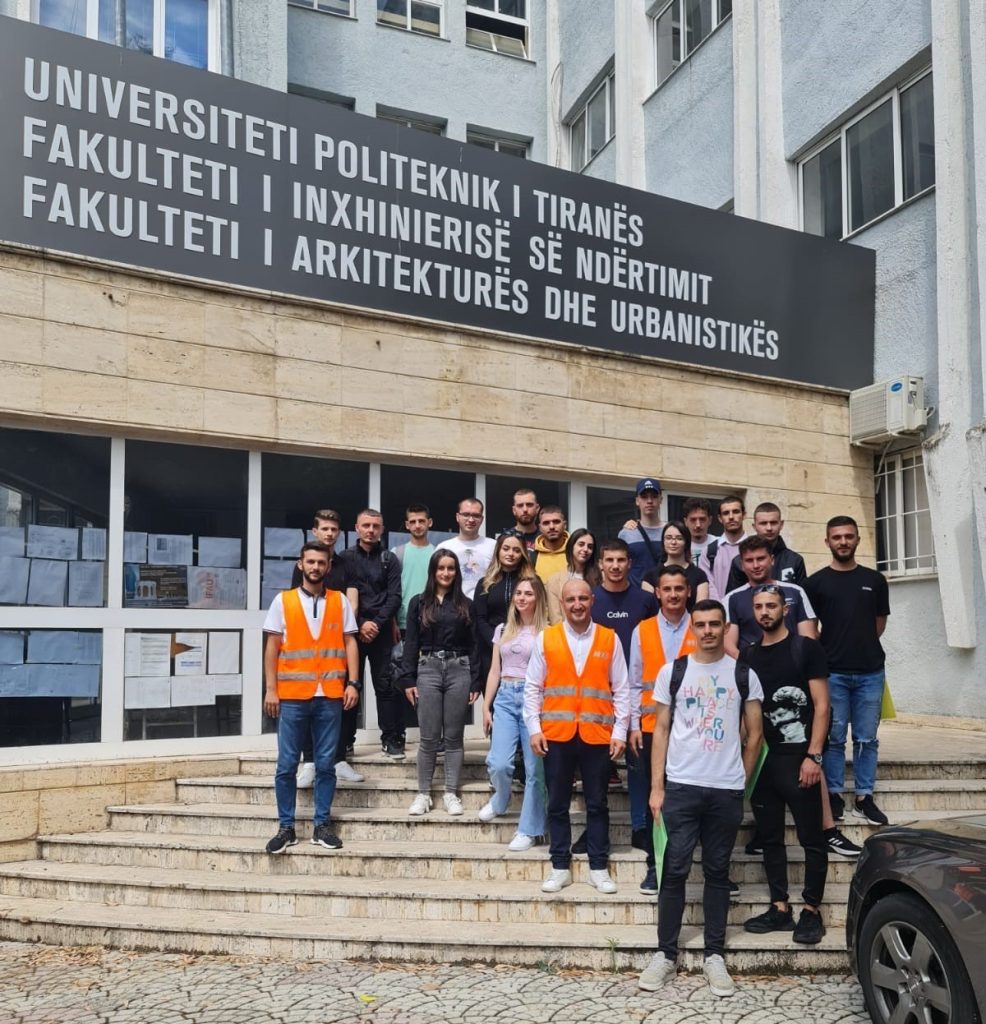
Professional practice with Geodesy students
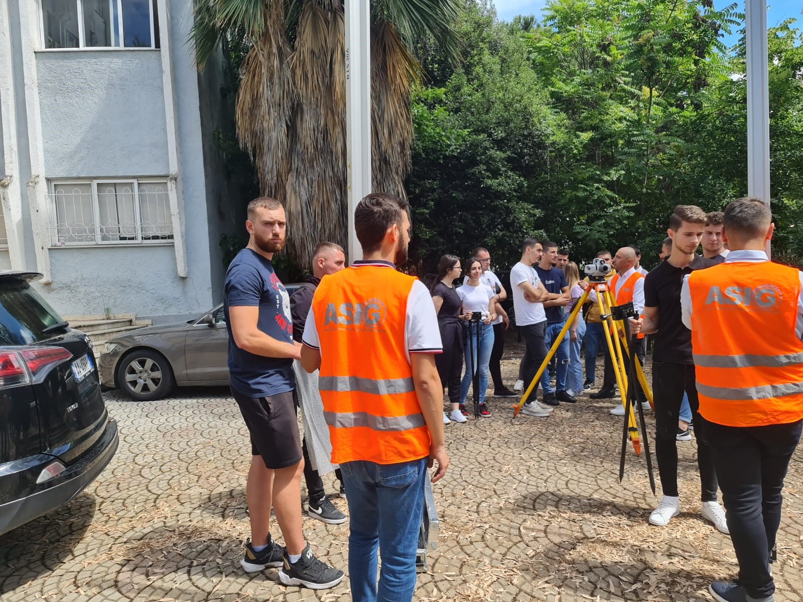
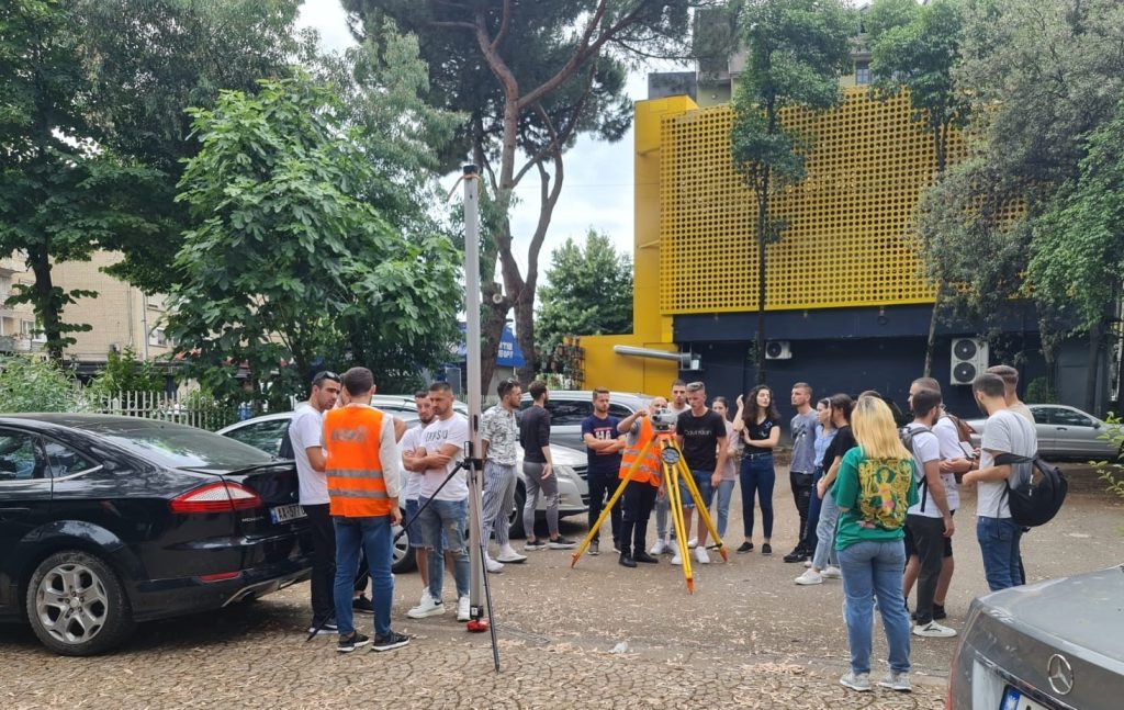
In the framework of the cooperation agreement between the Polytechnic University of Tirana and the State Authority for Geospatial Information (ASIG), the KRGJSH sector at ASIG, based on its work program, carried out on 9 and 10 June 2022, a professional internship with students of Geodesy of the Faculty of Civil Engineering (FIN), at the Polytechnic University of Tirana, on “Procedure for achieving high accuracy levelling”.
Students participating in this internship were introduced to the geodetic levelling equipment of class I, specifically with the Digital Level “Sokkia SDL1X”, Latv invar bar-code, slippers, etc., as well as the procedure for performing levelling accuracy high. During the professional internship on the premises of the Faculty of Civil Engineering (FIN), students participating in both Bachelor courses (BG-2A and BG-2B) were trained in the following processes:
- Sokkia SDL1X digital level controls
- Realization of the measurement of a round-trip leveling sector with several stations
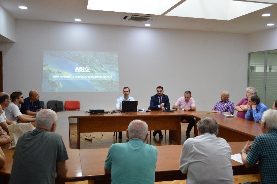
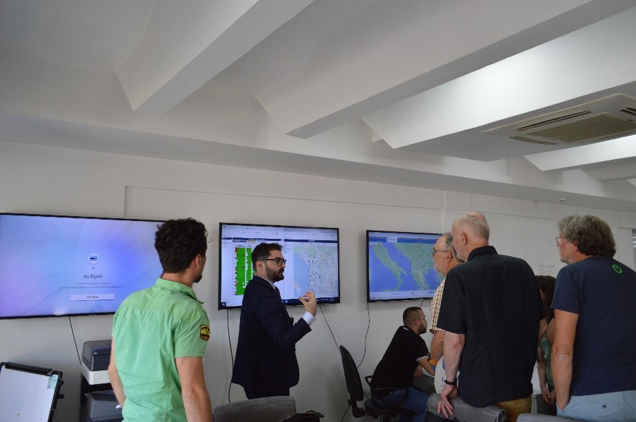
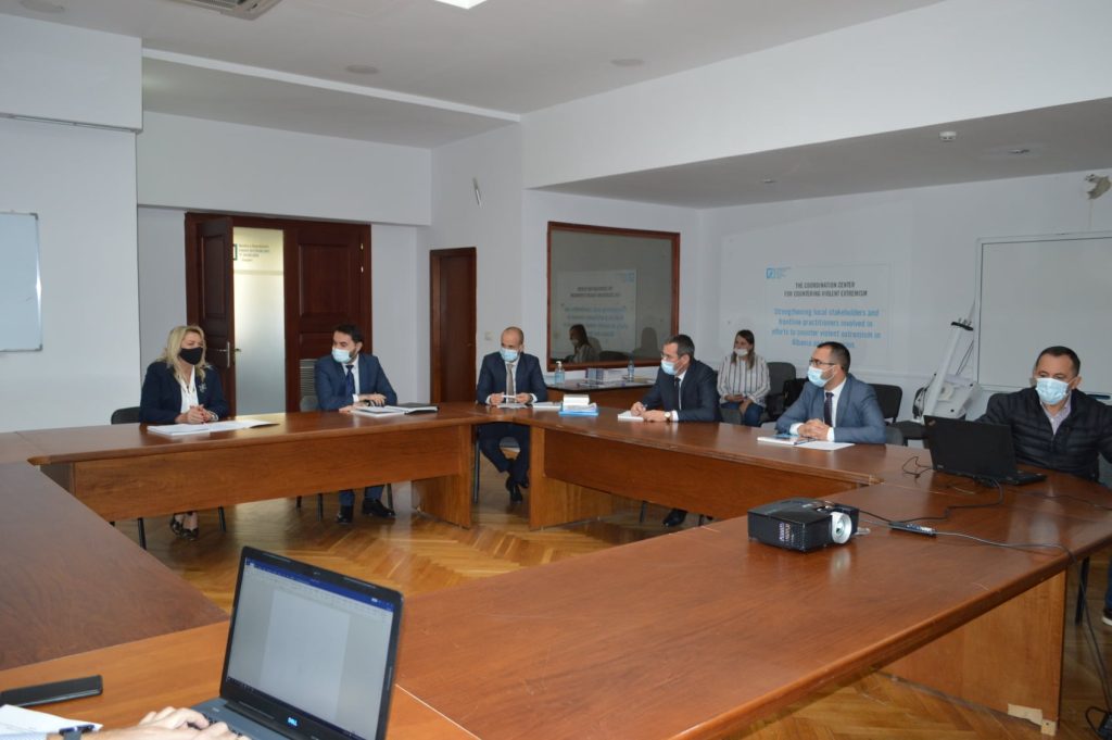
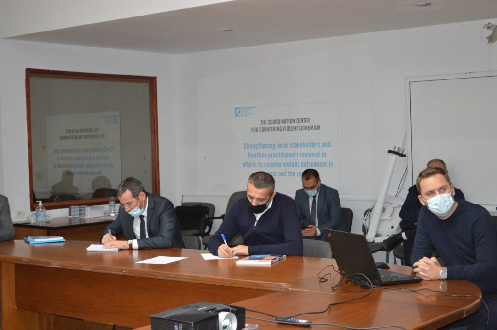
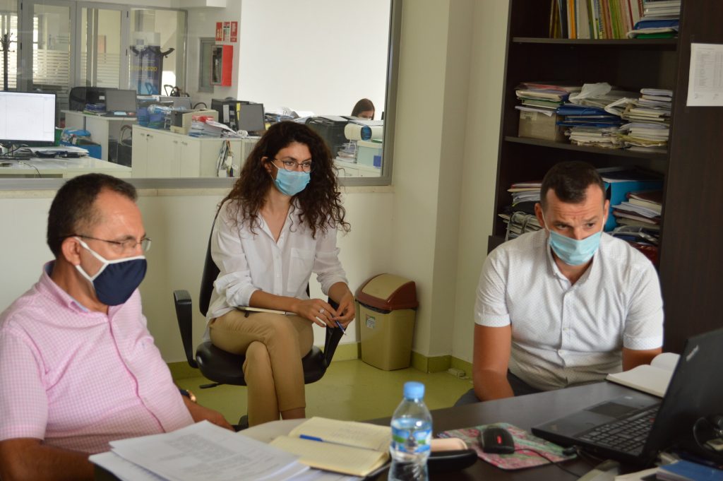
Visit of the representatives of the German Institute at ASIG
A group of representatives of the Institute for Rural Development of Lower Franconia, in the Land of Bavaria, Germany, including geodetic engineers, under the direction of Prof. Dr. Dhimitër Doka, from the Faculty of History and Philology, at the University of Tirana, realized a visit to the State Authority for Geospatial Information (ASIG) on 30.05.2022.
The purpose of the visit was to get acquainted with the mission and achievements of ASIG for the establishment of the National Geospatial Information Infrastructure (NSDI), in the Republic of Albania.
The General Director of ASIG, Mr. Lorenc Çala, made a brief presentation of the developments that the geoinformation sector has had in Albania, the difficulties encountered by ASIG in its beginnings and the achievements of this institution in carrying out its mission.
The head of the Directorate of National GIS and Geoportal Mr. Klaudio Çollaku, in his presentation, introduced the visitors to the activity and steps taken by ASIG for the creation of NSDI in Albania.
ASIG executives then answered questions and interest from visitors who also took a closer look at the ASIG premises and got acquainted with the technologies used by the staff of this institution..
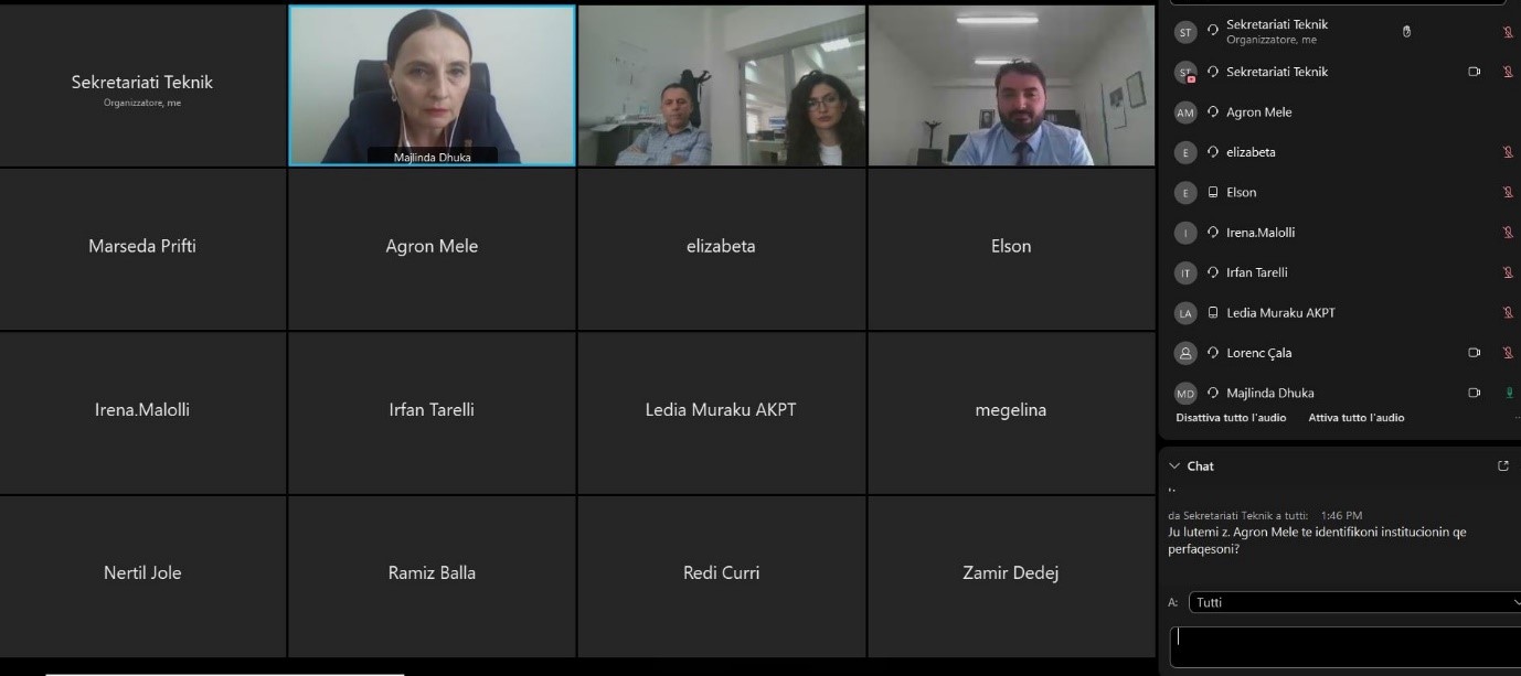
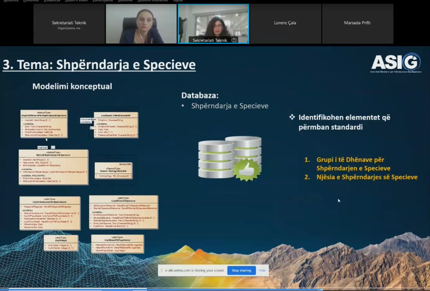
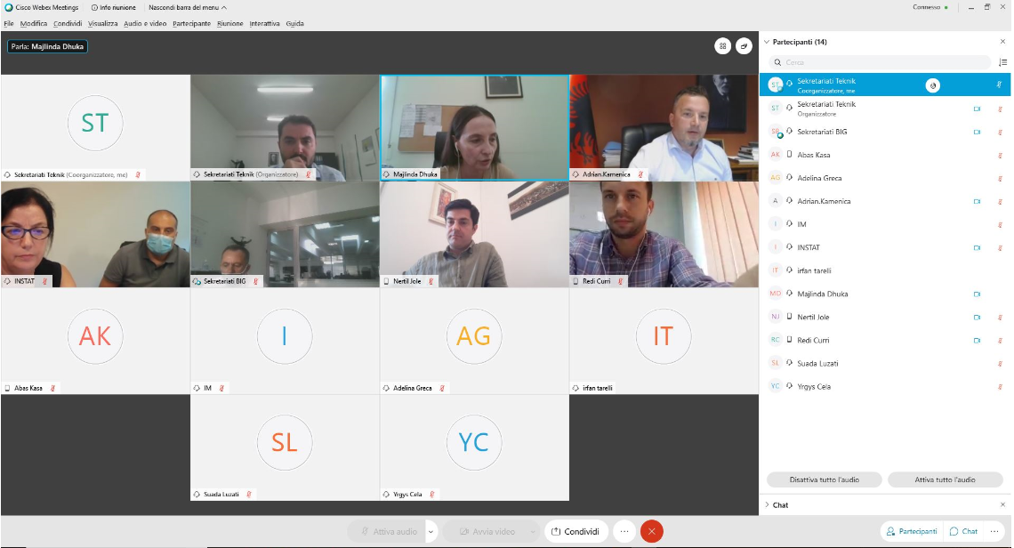
The meeting of the Geospatial Information Board on September 30, 2021″
On September 30, 2021, the online meeting of the Geospatial Information Board was held under the leadership of the Chairwoman of the Board, Ms. Majlinda Dhuka, Director of the Department for Development and Governance at the Prime Minister’s Office.
During this meeting, an overview of ASIG’s activities and achievements for the past period was presented. Additionally, national standards for the technical specifications of geospatial information in Albania were introduced and approved for the following topics:
Environmental monitoring infrastructure;
Agricultural and aquaculture infrastructure;
Industrial infrastructure;
Human health and safety;
Restricted use areas;
Habitats;
Ecological zones;
Species distribution;
Atmospheric conditions and meteorology;
Hydrology

CALL #6: NATIONAL INTERNSHIP PROGRAM
The sixth call of the Program is an opportunity for all young people aged 21 to 26 who have completed at least the first cycle of “Bachelor” studies and have not been part of the program in previous calls.
The requested profiles, the number of admissions, and the online application can be found at the following link:
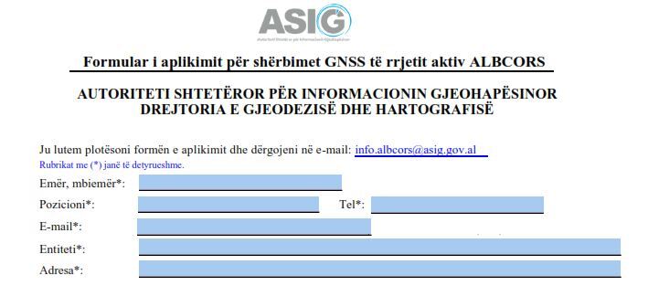
NOTIFICATION FOR USER REGISTRATION IN THE ALBCORS SYSTEM
The State Authority for Geospatial Information (ASIG), based on Article 7, point b, of Law No. 72/2012, dated 28.06.2012, “On the organization and functioning of the national infrastructure of geospatial data in the Republic of Albania,” and Decision No. 669 of the Council of Ministers, dated 7.8.2013, “On the approval of the rules for determining, creating, and implementing the Albanian Geodetic Reference Framework (KRGJSH), as metadata,” amended, administers, manages, stores, and processes the data of the ALBCORS system, ensuring access for the public and interested parties.
Continuing efforts to provide and improve GNSS services of the ALBCORS system, ASIG informs all public and private institutions, professional individuals, and various companies or organizations that, starting from the month of March, access to GNSS services will only be possible through the registration of users with dedicated usernames and passwords.
Every user must obtain the appropriate credentials by completing the Application Form (click).
ASIG will respond to the application within 2 working days.

1st GEOBIZ project Advisory Committee meeting
1st GEOBIZ PAC meeting was held online on December 2nd, 2020. On the meeting, project coordinator prof. Željko Bačić gave presentation about the Erasmus+ GEOBIZ project, its goals, organization and tasks and provided information about PAC relevance, purpose, tasks and organization of work.
According GEOBIZ project description, each GEOBIZ Associated Partners delegated one member to GEOBIZ Project Advisory Committee and they are:
-Slobodanka Ključanin, Federal Administration for Geodetic and Real Property Affairs of Federation Bosnia and Herzegovina (FGU),
-Božidar Pavičević, Real estate administration of Montenegro (REA),
-Maria Ovdii, Agency for Land Relations and Cadastre of the Republic of Moldova (ALRC),
-Klaudio Çollaku, State Authority for Geospatial Information (ASIG)
-Esat Xani, Kosovo Cadastre Agency (KCA).
The chairperson for year two of the Project lifetime has been elected by Committee members. The PAC elected chairperson is Prof. Slobodanka Ključanin from Federal Geodetic Administration of Federation Bosnia and Herzegovina.
Also, project coordinator informed PAC members about the coming PAC activities and tasks. There are two main PAC focuses: Evaluation of project deliverables and Participation in coming Business-Academia cooperation activities. The first PAC evaluation report, giving PAC members view on four Project deliverables is expected to be delivered end of January 2021.
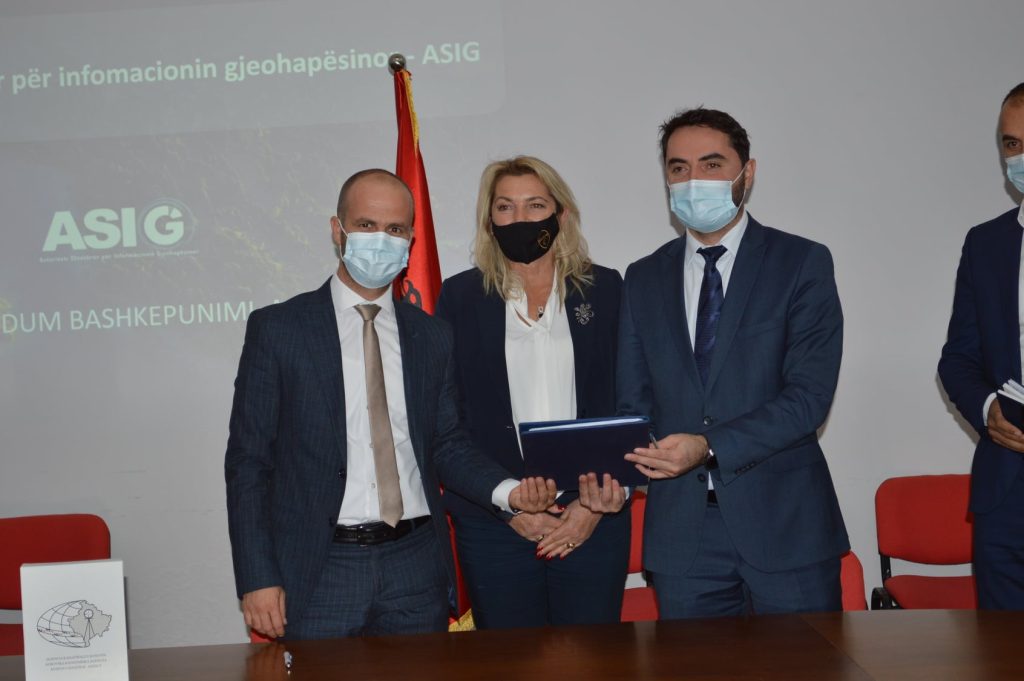
The State Authority for Geospatial Information signed a cooperation agreement with the Cadastral Agency of Kosovo
With a request from the State Authority for Geospatial Information, a delegation from the Cadastre Agency of Kosovo, led by the Executive Director, Mr. Avni Ahmeti, visited the premises of ASIG on October 23, 2020. The delegation from the Cadastre Agency of Kosovo was also joined by the Deputy Minister of the Ministry of Economy and Environment of the Republic of Kosovo, Ms. Burbuqe Bakija, with the aim of getting a closer look at the experiences and challenges of the institutions responsible for Geospatial Information Infrastructure in Albania and Kosovo. During the meeting, the leaders of ASIG presented the activities, projects, and challenges of the institution in building NSDI and highlighted the opportunities for cooperation between ASIG and AAK in the common challenges of the geoinformation field. The meeting was finalized with the signing of two cooperation agreements: – Cooperation Agreement in the field of Geospatial Information Infrastructure specifying the areas where cooperation between institutions can be deepened, such as geoinformation standards, exchange of experiences in professional fields, harmonization of geospatial data and their exchange. – Cooperation Agreement for the exchange of data from the ALBCORS and KOPOS geodetic networks for the use of the Active State Network Points of the Global Positioning System of the Republic of Albania (ALBCORS), by the Republic of Kosovo and the use of the permanent network points of the Republic of Kosovo (KOPOS) by the Republic of Albania. Through this cooperation, signal coverage will be provided for geodetic activities carried out in the border areas between the two countries.
Meeting of the Geospatial Information Board dated 15.09.2020
Under the direction of Ms. Majlinda Dhuka, Director of the Department of Governance Development at the Prime Minister’s Office and Chair of the Geospatial Information Board, an online meeting of the Geospatial Information Board – BIG was held on September 15, 2020. During this meeting, ASIG presented the planned activities for the second half of 2020, as well as important documents related to the National Geospatial Information Infrastructure in Albania, which enable interoperability and standardization of geospatial information. The geoinformation standards were presented and approved as follows:
– “State standards for technical specifications of geospatial information in Albania – theme “Demography”
-“State standards for technical specifications of geospatial information in Albania – theme “Statistical units”
-“State standards for technical specifications of geospatial information in Albania – theme “Seas”
“State standards for technical specifications of geospatial information in Albania – theme “Mineral resources”
-“State standards for technical specifications of geospatial information in Albania – theme “Energy resources”
-“State standards for technical specifications of geospatial information in Albania – theme “Urban infrastructure and government services”
-“State standards for technical specifications of geospatial information in Albania – theme “Pedology”
-“State standards for technical specifications of geospatial information in Albania – theme “Base map image”
The work of ASIG and the successful cooperation with the responsible public authorities were appreciated by the members of BIG .

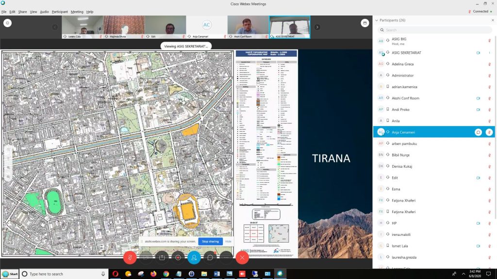
Meeting of the Geospatial Information Board dated 08.06.2020
Under the direction of Ms. Majlinda Dhuka, Director of the Department of Governance Development at the Prime Minister’s Office and Chair of the Geospatial Information Board, an online meeting of the Geospatial Information Board – BIG was held on June 8, 2020. During this meeting, ASIG presented important documents related to the National Geospatial Information Infrastructure in Albania, which enable interoperability and standardization of geospatial information.
The geoinformation standards were presented and approved as follows:
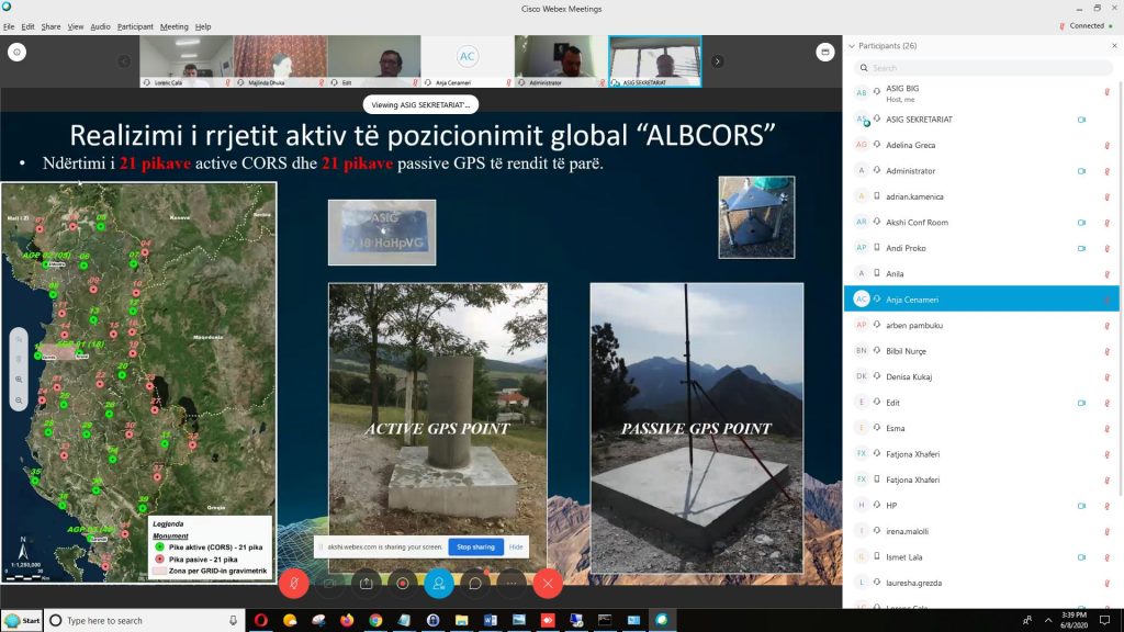
-“State standards for technical specifications of geospatial information in Albania – theme “Geodetic reference frame determination and geodetic control”
-“State standards for technical specifications of geospatial information in Albania – theme “Geographic network system”
– “State standards for technical specifications of geospatial information in Albania – theme “Protected areas”
– “State standards for technical specifications of geospatial information in Albania – theme “Land cover”
– “State standards for technical specifications of geospatial information in Albania – theme “Land use”
– “State standards for technical specifications of geospatial information in Albania – theme “Natural risk zones”
Representatives of the project that collaborates with MZHBR also presented the GIS project of AZHBR, which was approved in principle