 English
 Shqip
Shqip
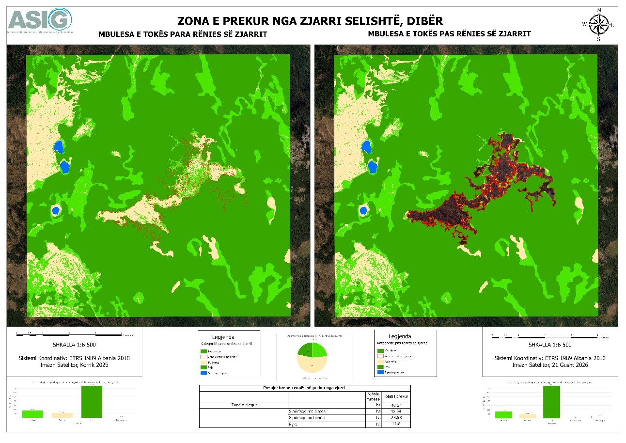
The work of experts from the State Authority for Geospatial Information (ASIG) continues in support of the National Civil Protection Agency (AKMC) to prepare a thematic map for the area affected by the fire, based on the analysis and interpretation of satellite images.
From the analysis of satellite images, through the use of advanced technologies, a landcover map has been prepared which identifies the areas affected by the fire, making an analysis of all damaged layers for the area of interest Selishte, Dibër.
This analysis enables the identification and documentation of the affected surfaces, providing valuable information for monitoring the situation and assessing the impact of the fire on the territory.
The damaged area results in a burned area of approximately 48.57 ha, divided according to land cover categories into:
- 12.84 ha of vegetated area;
- 23.93 ha of bare area;
- 11.8 ha of forested area.