
Innovation Week (High Tech Expo)


Summary relation ; Table of transformation coefficients
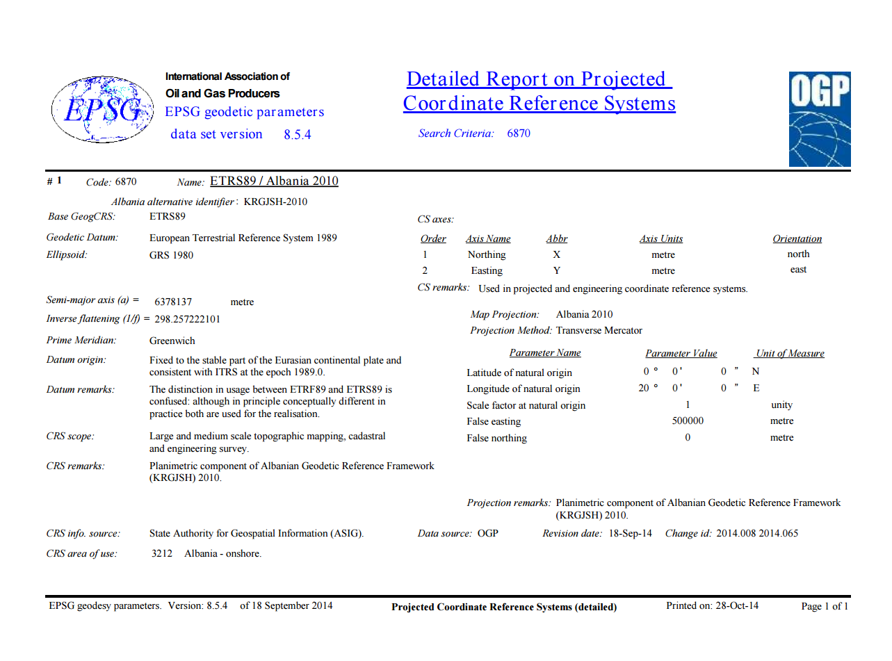
KRGJSH 2010
KRGJSH-2010
Albanian Geodetic Frame which is in use in the Republic of Albania, is approved by the Decision of Council of Ministers no. 669, dated on 08/07/2013 and it is called:
“Korniza Rreferuese Gjeodezike Shqiptare 2010” (KRGJSH-2010), “2010”, is the index related with the “epoch” used to define geodetic coordinates for all the geodetic points in the Republic of Albania.
KRGJSH-2010, shall be determined on the basis of the European Geodetic Reference System. KRGJSH- 2010, shall be used for all the applications associated with the use of geodetic coordinates in the country. Relationship between KRGJSH-2010 and the classic coordinate reference systems which are used in our country, until the entry into force of the KRGJSH-2010, will be made by using the transformation parameters calculated for each case.
KRGJSH-2010 includes:
I. Fundamental geodetic parameters determined in Geodetic Reference System (GRS-80):
1) Equatorial radius; a = 6 378 137m
2)Geocentric gravitational constant, including mass of the atmosphere; GM = 3 986 005 x 10-8 m3s-2
3) Dynamical form factor; J2 = 108 263 x 10-8
4)Reciprocal of flattening; 1/f = 298.257 222 101
5)Angular velocity of rotation; ? = 7 292115.0 x 10-11rad.sek-1
II.Geodetic coordinate system ETRS89. Realization ETRF2000, Epoch 2010. III.Height system. The System shall be realized through the bench marks the State Leveling Networks involved in the United European Levelling Network (UELN) defined in European Vertical Reference System (EVRS) using gravity data defined in the unified system International Gravity Standardization Network 1971 (IGSN 1971).
IV. System of plain coordinates. The system of plain coordinates shall be realized using two Cartographic Projections:
1.Transverse Mercator Projection (TMzn), for mapping at scales larger than 1:500 000.
2.Lambert Conic Conformal Projection, for mapping at scales smaller than 1:500 000.
3.Central Meridian: ? = 20 0 ; 4. Scale factor at the central meridian: 1; 5. False easting: 500 000 m; 6. False northing: 0 m;

Workshop “Working Group for Hydrography”
National Authority for Geospatial Information (ASIG) is working seriously in creating a national geo-information infrastructure (NSDI) based on the INSPIRE Directive. In view of this common group has been established ASIG and the Technical Secretariat of the National Water Council aiming at establishing standards and hydrographic data structure as one of the main themes of this directive. On the basis of results and this experience, will be treated and other topics covered by the annexes of this Directive.


ASIG Strategic Business Plan
Workshop: “Preparation of Strategic Business Plan of the State Authority for Geospatial Information (ASIG)”, organized by the company Magnum Opus Group (MOG) responsible for the preparation of 5-year ASIG SBP. The meeting was attended by representatives of the Norwegian Mapping Authority (Kartverk) as donors of the project to create a national infrastructure of geospatial data and representatives from the National Authority for Geospatial Information (ASIG).


1.2 million euros donation from the Norwegian government to establish NSDI
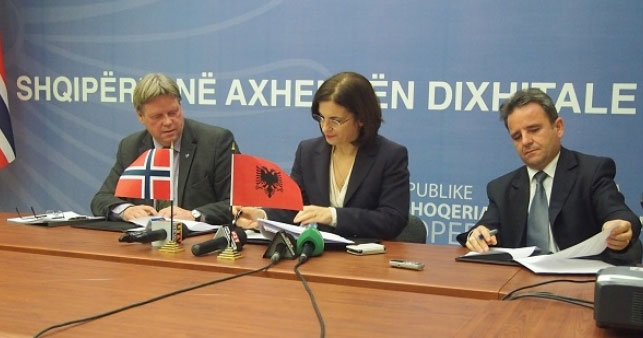
Minister for Innovation and Public Administration Milena Harito today signed an agreement for the support of 1.2 million euros, provided by the Norwegian government to create a national infrastructure of geospatial data (National Spatial Data Infrastructure, NSDI).
This agreement will enable firstly, raising the Albanian Authority of Geospatial Infrastructure as an institution responsible for the implementation of the INSPIRE Directive; Albanian Geodetic Reference Frame construction (KRGJSH-2010) as a reference of European standards for “National GIS”; Construction of “National Geoportal”, through which they will access the geospatial data and services associated with these data.
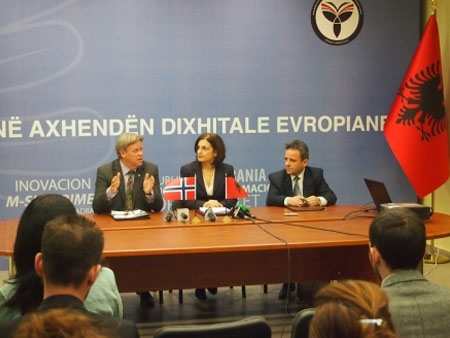
In greeting the audience, Harito Minister stated that “The signing of this agreement is not only a sign of friendship and mutual support of the governments of the two countries, but also an indicator of great importance in the development of infrastructure, processing and use of the geospatial data »
In this context, Harito stressed that the creation of the modern national infrastructure of geospatial data NSDI with European standards, is presented as a necessity under government commitments,in the integration process.
Signing the agreement was made on the environments of AKSHI, on the topic “Albania in the European digital agenda”. On the Norwegian side the agreement was signed by Mr. Helge Onsrud, Director of the Centre for Development regarding Property Rights, at “Statens Kartverk”.