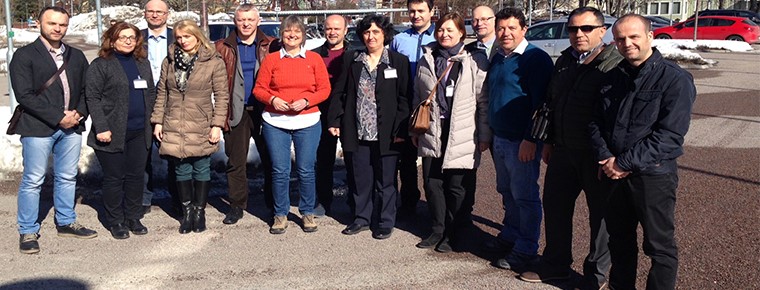
Participation in the workshop on the coordination of NSDI
Representatives of the State Geospatial Information Authority (ASIG) participated in the workshop organized under the IMPULS project on “Developing Coordination Processes and Recognition at Work with Data Distribution Models”. In this workshop held on March 27-29, in Gävle, Sweden, the achievements of each country participating in the project “IMPULS” were presented in the field of geospatial data infrastructure development, and in particular the role and responsibilities of the coordinating structures.
The focus of the activities was the presentation of the coordinating organizational structure for the implementation of the NSDI in each country, respectively the State Authority for Geospatial Information (ASIG). Also in this workshop, representatives of ASIG have introduced the model created for the dissemination of data through online services of the National Geoportal.
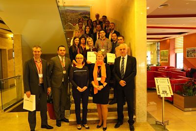
Development of NSDI and the INSPIRE Directive
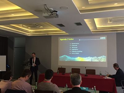
Representatives from the State Authority for Geospatial Information (ASIG) participated in a workshop held from April 3-5, 2018, in Monstar, Bosnia-Herzegovina. The workshop focused on the development of the National Spatial Data Infrastructure (NSDI) and the implementation of the INSPIRE Directive. Discussions revolved around strengthening the institutional and organizational capacities of participating organizations in the region as developers, managers, and contributors to the NSDI platform, as well as the implementation of the INSPIRE Directive.
ASIG representatives presented the situation and the role of the State Authority for Geospatial Information in the development of NSDI and INSPIRE. They emphasized the importance, vision, and impact of this authority on geospatial information production. Key points discussed included:
• Legislation (national laws on INSPIRE, licensing, conditions for data distribution)
• Financial costs of implementation
• Development of the National Geoportal, Software Architecture level, validity, and usefulness of the National Geoportal.
The capacities for building NSDI in Albania, priorities, weaknesses, opportunities, and risks related to the implementation of NSDI and the INSPIRE Directive were also discussed.
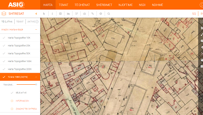
Maps of the Central Technical Archive of Construction are published
ASIG has published maps available on the National Geoportal provided by the Central Technical Archive of Construction (AQTN) titled “1:500 Scale Sheets for the city of Tirana, 1980.” These sheets were constructed using tacheometric methods by the former Geology-Geodesy enterprise. The primary purpose of creating these sheets was to generate maps and plans for territories where cities and large engineering works were located, at scales of 1:500 and 1:1000. ASIG’s goal in publishing them is to assist institutions and the public, particularly in matters related to planning and property. For more information, you can refer to the metadata of the layer “Tirana 1980 (AQTN)” at the following link: https://geoportal.asig.gov.al/geonetwork/srv/alb/catalog.search?auto=true#/metadata/abfb3644-2f0d-4024-864c-0629b04a0e34

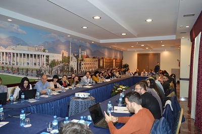
IPA DRAM NATURAL RISK MANAGEMENT WORKSHOP ALBANIA
Representatives of the State Geospatial Information Authority participated in the workshop on Ntural Risk Managment, organized by the IPA DRAM Program Mission on February 26-27, 2018 at the Tirana International Hotel in cooperation with the General Directorate of Civil Emergencies . The main issues addressed in this workshop were:
1- General Descriptions on Risk Concepts, Natural Hazards and Natural Disaster Management.
2-Data Acquisition Training in the Desinventar Program (new software version), which enables linking of natural disaster information to geographic positioning.
3- Risk assessment and disaster management by simulating some concrete cases according to different methods.
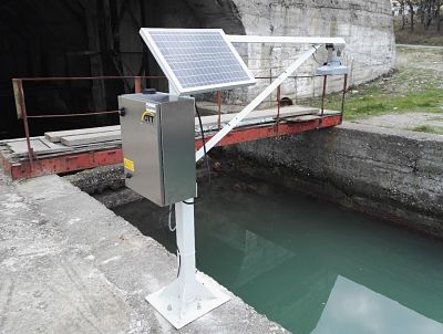
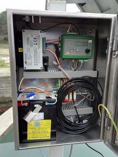
After 25 years, the new Mareographic station is put into operation
The State Authority for Geospatial Information (ASIG), mandated by Law no. 72/2012, “On the organization and functioning of the national infrastructure of geospatial information in the Republic of Albania,” as the authority responsible for creating and maintaining the Albanian Geodetic Reference Frame, has developed the project for the Tide Gauge Network in the Republic of Albania.
In fulfilling this task, ASIG has initiated the implementation of this project by commissioning the Tide Gauge in Kepi i Palit (Durrës), ending a 25-year absence of information on sea level monitoring. This project is being implemented with Norwegian assistance through the ALNO-HIP project, which aims to build two tide gauge stations in Durrës and Sarandë. It is expected that the Sarandë station will be operational by April of this year. ASIG also plans, with the funds made available by the Albanian government, to construct and install two additional tide gauge stations (Shëngjin and Orikum). All these efforts are part of the realization of the national project for geodetic networks. These stations will fill a long-standing gap in data on sea level along the Albanian coastline, crucial as a baseline for creating the Albanian Geodetic Reference. The data generated, analyzed, and published will meet the requirements of various agencies: state institutions, local authorities, and international entities involved in studying the dynamics of the Albanian coastline. The data from the tide gauges installed along the coastline will be transmitted through an online communication line from the stations to the control center at ASIG. Subsequently, this data will undergo relevant processing and analysis to calculate the average sea level, LAT, etc., which will be published through a dedicated service on the official ASIG website.

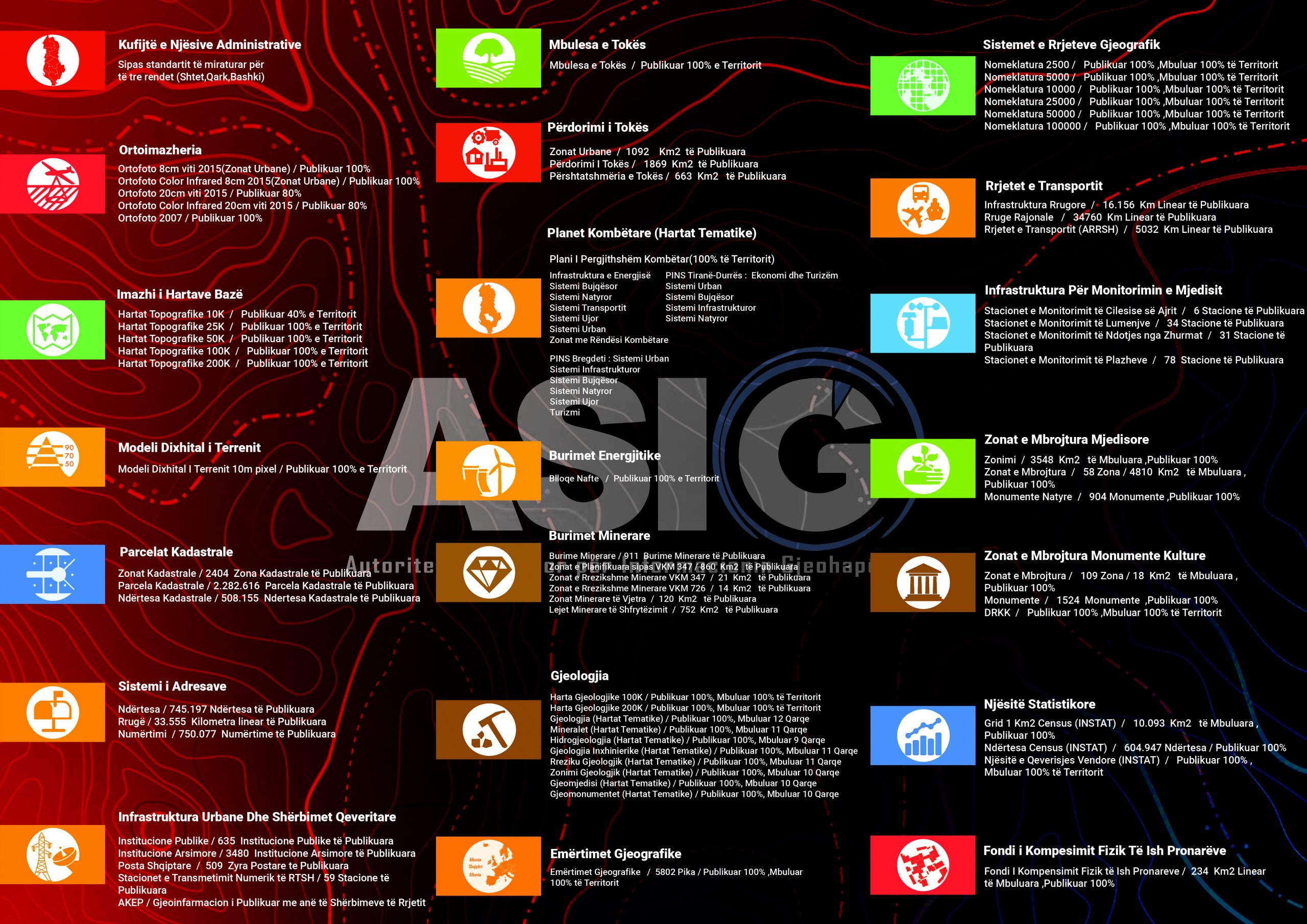
Data published on the National Geoportal
The State Authority for Geospatial Information (ASIG), in the 4-year period of its operation, has taken important steps in the realization of its mission, the construction of the National Infrastructure of Geospatial Information in the Republic of Albania, based on Law No. 72/2012, dated 28.06.2012, “On the Organization and Operation of the National Geospatial Information Infrastructure in the Republic of Albania”. One of the most important achievements of ASIG is the construction of the National Geoportal, which provides network services, in full compliance with Law 72/2012 and Directive 2007/2/EC “INSPIRE”, of the European Parliament and Council. The National Geoportal offers institutions, business, the public and any other interested parties geospatial data and services for a number of topics of Article 11 of Law 72/2012, which you can find in the material below. More information about published data and services can be found on the metadata of each layer, in the catalog of metadata published in the National Geoportal (https://geoportal.asig.gov.al/geonetwork)
List of data published in the National Geoportal
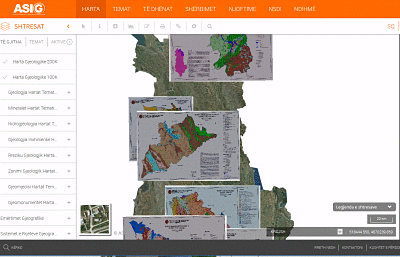
Geology Thematic Maps are published
ASIG, in collaboration with the Albanian Geological Survey, has published thematic maps on the National Geoportal for the topic “Geology” for the following regions: Berat, Dibër, Durrës, Elbasan, Fier, Gjirokastër, Korçë, Kukës, Lezhë, Shkodër, Tiranë, Vlorë. For more information, click on the link:

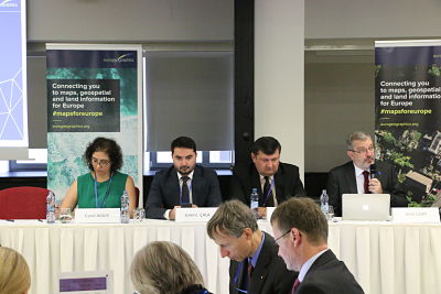
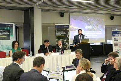
Participation in the Eurogeographics General Assembly
Heads of the State Authority for Geospatial Information, Mr. Lorenc Çala General Director, Mr. Kristaq Qirko head of the Geodesy and Cartography Directory, Mr. Klaudio Çollaku, head of the National GIS and Geoportal Directory participated in the General Assembly of Eurogeographics held on 07-10.10.2018 in Prague, Czech Republic.
Key topic for discussion were:
• In the age of ‘Big Data’ and the ‘Internet of Things’, how can we know which data sources can be trusted, particularly for decisions that affect all our lives?
• What is authoritative data and why is it important?
• What role can NMCAs play to help tackle the important issues of today and tomorrow, as well as critical applications required for the public good?


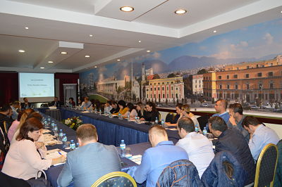
Geospatial Information Infrastructure in Albania – National Geoportal
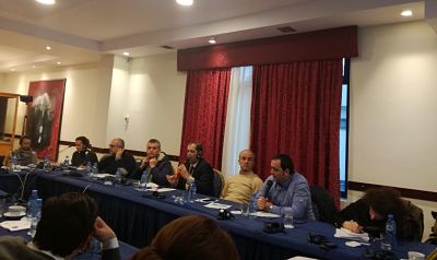
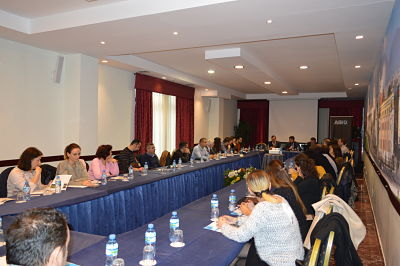
In the premises of Hotel Tirana International, ASIG, as part of the IMPULS project, conducted a workshop with the theme “Geospatial Information Infrastructure in Albania – National Geoportal.” The workshop was attended by representatives of public authorities responsible for the topics covered in Article 11 of Law 72/2012 “On the organization and functioning of the National Geospatial Information Infrastructure in the Republic of Albania,” as well as representatives of other institutions whose work is based on geospatial information. The objective of this workshop was to enable responsible public authorities to benefit from the services of the National Geoportal through live demonstrations related to user registration, metadata creation, and data download.
The workshop presenters emphasized the importance of the National Geospatial Information Infrastructure in the decision-making process, the steps taken for the implementation of the INSPIRE directive, and the services provided by the National Geoportal for public authorities. ASIG experts provided a live demonstration of the user registration process on the Geoportal, editing and updating metadata for relevant layers, as well as the network services offered through it, including metadata discovery, data viewing, and downloading.

National Internship Program
– The program is an opportunity for young professionals aged 21 to 26 from Albania and the Diaspora who have completed at least the first cycle of bachelor’s studies.
-The National Work Placement Program aims to provide a qualifying experience that influences the development of professional, academic, and personal skills, as well as familiarity with public administration.
– The development of the work placement is free of charge; however, the work placement period will be recognized as work experience during recruitment in public administration institutions.
-After thoroughly understanding the program and consulting the required profiles, you can proceed with completing the application form. One of the key documents you need to complete is the letter of motivation.