ASIG Analysis of 2018
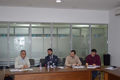
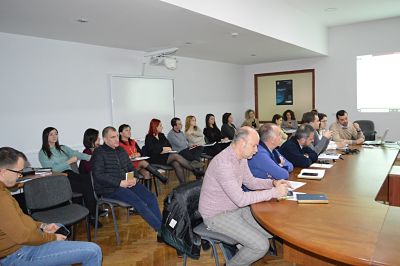
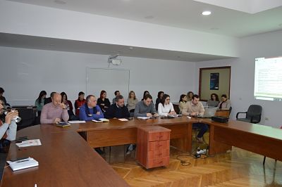
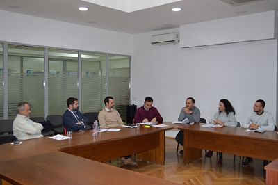
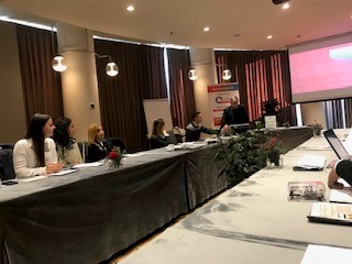
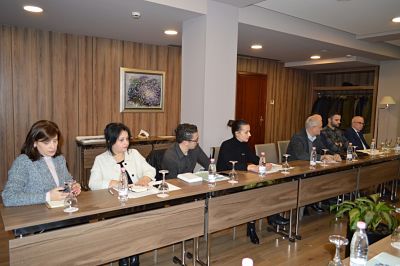
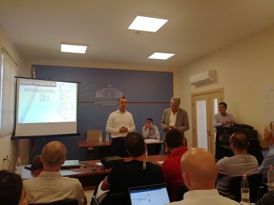
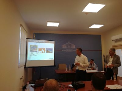
In the premises of the Europa Hall, on January 14, 2019, the annual analysis of ASIG for the year 2018 was conducted.
The General Director of the State Authority for Geospatial Information, Mr. Lorenc Çala, thanked all the members of the ASIG staff for their work and maximum commitment in achieving the major objectives of ASIG for the past year.
Subsequently, the respective directors of ASIG presented the achievements and products of each sector, as well as the challenges encountered in their realization.

Call for expression of interest for the employment of recent graduates
Job Vacancies for the executive level at ASIG for the year 2019.
1. Degree Type: “Geodesy/Geoinformatics” – Minimum degree level: “Bachelor”, Sector of Standards for Geoinformation, Directorate of GIS and Geoportal, State Authority for Geospatial Information . –1 Specialist.
2.Degree Type: “Geodesy/Geoinformatics/Urban Planning” – Minimum degree level: “Bachelor”, National GIS Sector, Directorate of GIS and Geoportal, State Authority for Geospatial Information – 1 Specialist.
3.Degree Type: “Geodesy/Topogeodesy” – Minimum degree level: Bachelor, Geodetic Reference Framework Sector, Directorate of Geodesy and Cartography, State Authority for Geospatial Information – 1 Specialist.
4. Degree Type: “Geodesy/Topogeodesy” – Minimum degree level: Bachelor, Remote Sensing Sector, Directorate of Geodesy and Cartography, State Authority for Geospatial Information – 2 Specialist.
The deadline for submitting documents is January 27, 2019.
More information about the criteria you need to meet and the application process can be found on the official website of the Department of Public Administration at the following link:
http://www.hrm.gov.al/ShowStudentsPublication.aspx?ID=2
Participation in the Second Interactive Forum of Innovators for Drought BRIGAID/AKPT
Collaborative Meeting of National Stakeholders within the Framework of the Regional Initiative, GEO-CRADLE
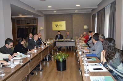
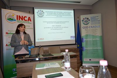
In the framework of the GEO-CRADLE project, funded by the European Union’s HORIZON 2020 Program, the Institute for Nature Conservation (INCA) in Albania, in collaboration with the State Authority for Geospatial Information (ASIG), organized a meeting on December 19, 2018, with national institutional stakeholders to engage them in regional initiatives for land observation and monitoring.
The purpose of this meeting was to present the achievements of this regional initiative coordinated by the National Observatory of Athens (NOA), aiming at the possibility of utilizing the national network of key stakeholders who practically use geospatial data in their operations, as well as applying statistical models for land observation and monitoring.
Part of this initiative is the nomination of ASIG as the GEO program focal point for Albania, to create opportunities for information, access, and collaboration through this program with partners in the Balkan region, Europe, and beyond.
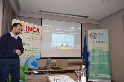
ASIG Director, Mr. Lorenc Çala, in his welcoming speech, emphasized the steps taken to build the National Geospatial Information Infrastructure and the need for collaboration with national, regional, and European initiatives in the field of geoinformation.
The Director of the National GIS and Geoportal Directorate at ASIG, Mr. Klaudio Çollaku, gave a presentation during this meeting highlighting the responsibilities and achievements of this authority, as well as the reasons why ASIG can serve as the GEO program focal point for Albania..

Seminar on National Cybersecurity
At the seminar on “National Cyber Security, CERT/CSIRT Framework & Activities” organized by the National Authority for Electronic Certification and Cyber Security (AKCESK) in collaboration with KISA (Korea Internet & Security Agency), specialists from the National Geospatial Information Authority (ASIG), specifically from the National Geoportal sector, were present.
Some of the key issues addressed in this seminar were:
1. Information security challenges in the digital technology world.
2. Colossal effects and damages in monetary values resulting from cyber attacks.
3. Types and categories of risks most encountered on the internet.
4. The security provided by KISA with its products to protect users.
5.The experience offered by KISA experts in eliminating risks arising from cyber attacks.
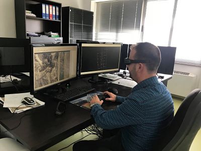
Workshop on the use of photogrammetry “Summit Evolution”, “Match-AT”, “Ortho Vista” and “Microstation” softwares
At the workshop organized under the premises of the State Authority for Geospatial Information, on 28.10-01.11.2018, attended by representatives of the Remote Sensing Sector in ASIG, with the assistance of a specialist of the Norwegian Cartography and Cadastre Authority(Statens Kartverk).
This training focused on the use of “Summit Evolution”, “Match-AT”, “Ortho Vista” and “Microstation” photogrammetric softwares.
The training program offered basic knowledge on the photogrammetric softwares, their functionalities, the efficiency and the creation of a 1994 air photography project.
The project was designed to create the Ortofoto of 1994, for a pilot area, with historical photographs of the city of Tirana, taken from the 1994 air flight.
Following the completion of the pilot project, with the assistance of the Norwegian specialists of Statens Kartverk, is working to set up the Ortofoto of 1994 for the whole territory of the Republic of Albania.
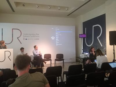
Participation in the workshop on “Understanding Natural Risks in the Balkans”
In the workshop on “Understanding Natural Risk in the Balkans”, held on 17-19 September 2018, in Belgrade, Serbia, the State Authority for Geospatial Information was represented by Mr. Michel Millja head of Geoinformation Standards Sector .
The purpose of this workshop was to provide a discussion forum among the Balkan countries to share best experiences regarding: risk management, dealing with the natural risks of the future, developing risk management technology, such as and the social, physical and financial impact of natural disasters. This workshop was facilitated by the Government of Serbia in cooperation with the World Bank.
Following this meeting on September 21, 2018, at the premises of the Ministry of Infrastructure and Energy, Tirana, was held a workshop on “Climate Resilient Road Asset in Albania”, in this workshop three issues were discussed:
– Progress and preliminary results of Risk analysis for climate resilient road assets in Albania.
– Floods analysis, landslides and seismicities analysis .
– Presentation of risk maps, risk analysis and economic impact analysis.
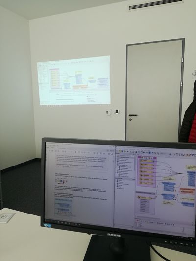
Workshop on the use of the Feature Manipulation Engine (FME) Software for the harmonization and implementation of geospatial data conforming to the geoinformation standards
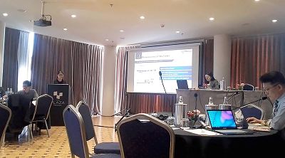
Representatives of State Authority for Geospatial Information , Mr. Michel Millja, Mrs. Denisa Kukaj of the Geoinformation Standards Sector and Mr. Erin Mlloja, the National GIS Sector participated in the Workshop on Use of Feature Manipulation Engine (FME) for the harmonization and implementation of geospatial data conforming to the geoinformation standards held on 01-04 October 2018, in Zagreb, Croatia.
This training aimed at gaining the skills in use of FME software on the harmonization and implementation of geospatial data conforming to the INSPIRE directive. Some of the most important issues covered by this training were:
• Basic knowledge in using the FME software (creation, processing and modeling of work processes).
• Interpretation of INSPIRE’s conceptual data modeling (UML-Language) according to the FME software (general elements).
•Harmonization of existing geospatial information according to data specification for geoinformation themes.
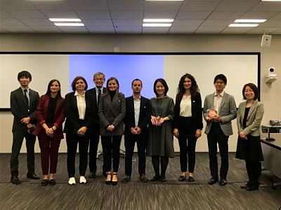
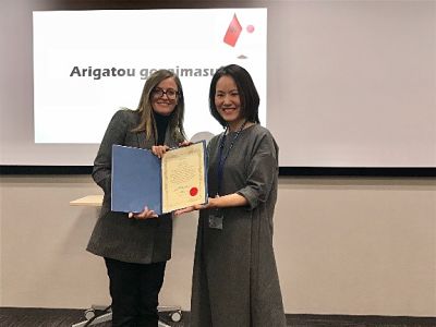
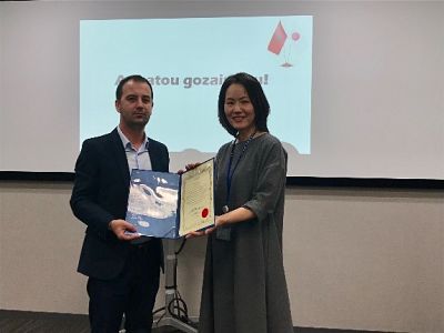
Training under the project “Geospatial information for sustainable development of the territory in the area of high intensity Tirana- Durres development “
Specialists from the State Authority for Geospatial Information from the sectors of Remote Sensing, Cartography and the Sector of Geoinformation Standards participated in a two-week training in the framework of the project with the Japan International Cooperation Agency JICA on 13-27.10.2018 in Tokyo, Japan.
Developing training in an institution and private company with tasks and responsibilities similar to those of ASIG offered the opportunity to exchange experience not only on the technical and professional side, but also on organizational and managerial skills by seeing and studying the way they are planned and realized working processes from relevant sectors operating in the field of Photogrammetry and Remote Sensing.
The training program provided basic knowledge and experience exchange in the field of photogrammetry and remote sensing technology as well as the most modern methods in use in Japan, the way of managing, creating, updating and maintaining cartographic information according to the latest trends.
The knowledge and experience gained from this training greatly help in improving the work methodology, solving some problems related to the lack of experience in the field of photogrammetry and providing a good support base for the creation, maintenance, updating of the basic mapping .
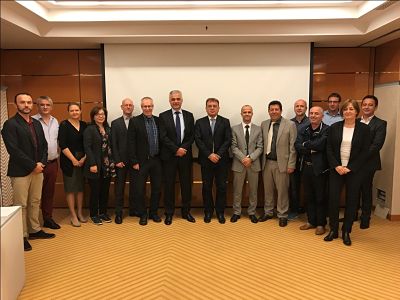
Participation of ASIG in the Steering Committee of IMPULS Project
ASIG coordinator for IMPULS Project Mr. Dritan Prifti attended the meeting of the Steering Committee of this project which was held on 18.10.2018 in Zagreb, Croatia. This meeting was attended by the heads of institutions responsible for geospatial data infrastructure of Western Balkan countries, part of this project.
The participants discussed the IMPULS project’s progress, achievements and eventual challenges until its completion, which is expected to be December 31, 2019. At this meeting, Mr. Prifti presented some of ASIG’s achievements such as;
Increase of public awareness on the benefits of geoinformation, professional development and training opportunities for capacity building of responsible public authorities, harmonization of geospatial data and creation of metadata for this data. Also reported the steps which has been taken to build a platform for delivering geospatial services according to dataexchange format standards, network service standards that will be used in the National GIS by broader users.
The project leaders highlighted the fact that ASIG is successfully fulfilling its geoinformation tasks alongside other countries of the region as well as the European Union countries.