English
 Shqip
Shqip
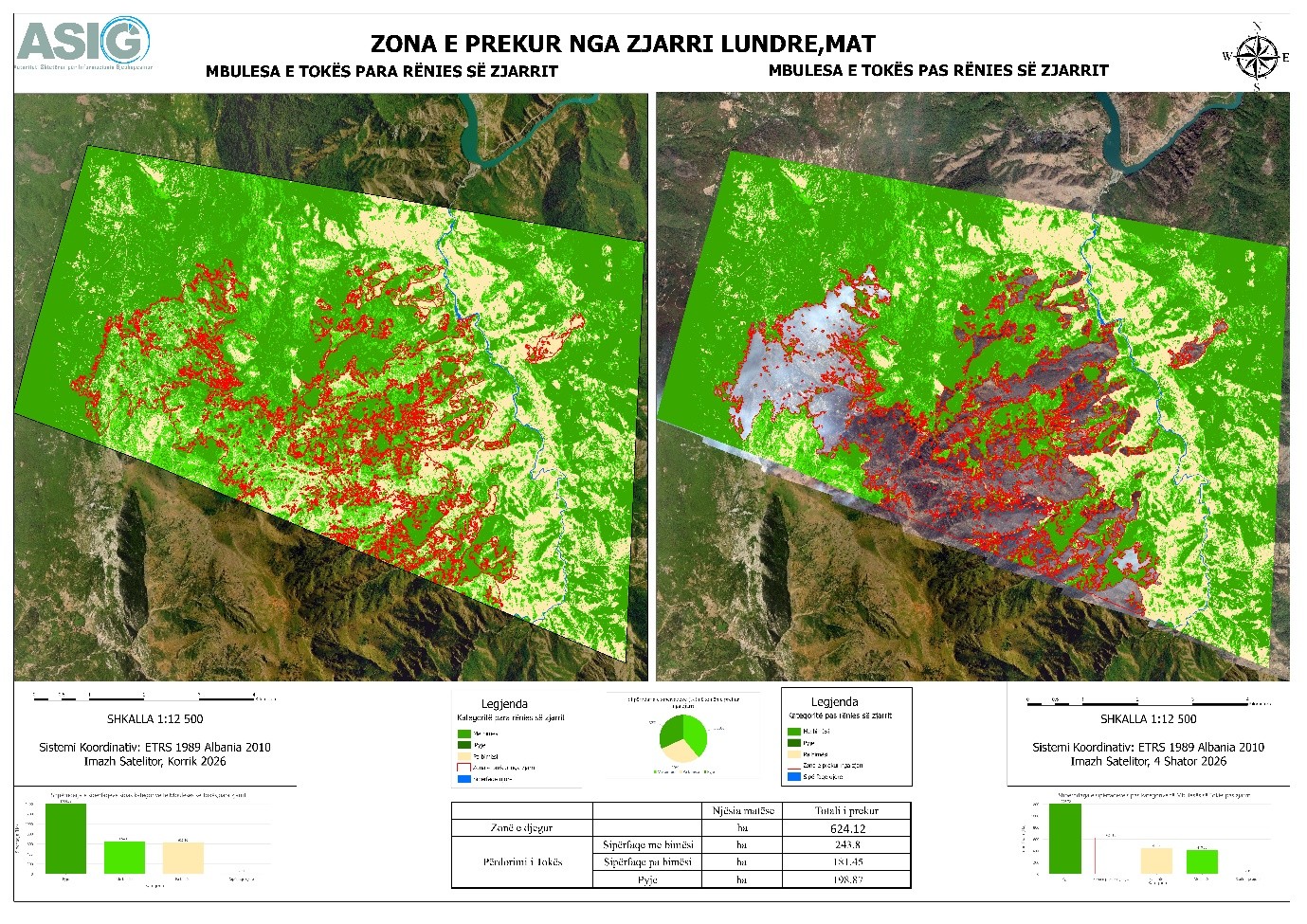
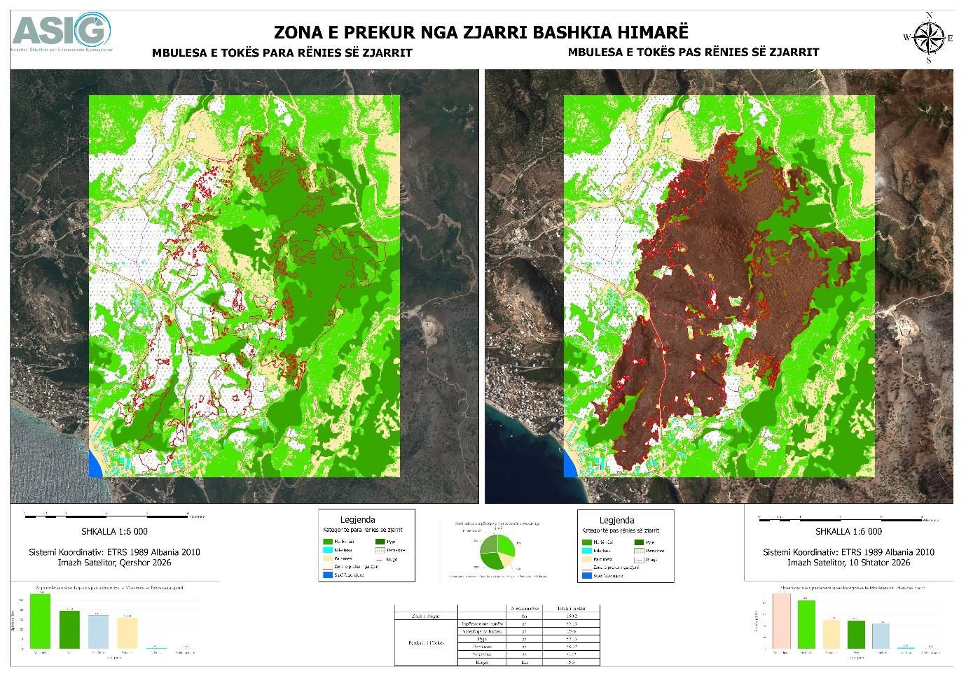
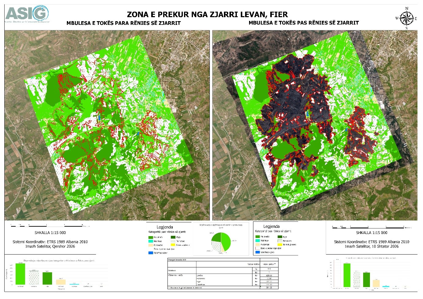
State Authority for Geospatial Information (ASIG) has prepared land cover maps using satellite imagery analysis and advanced technologies in support of the National Civil Protection Agency (AKMC) that identify the areas affected by fire in Lundre (Mat), the Municipality of Himarë, and Levan (Fier).
This analysis enables the identification and documentation of affected areas, providing valuable information for monitoring the situation and assessing the impact of the fires in these locations.
The fire-damaged area for each zone is as follows:
624.12 ha – Lundre, Mat;
190.2 ha – Municipality of Himarë;
981.08 ha – Levan, Fier.
The use of advanced technologies provides geospatial information with detailed analyses categorized by land cover type, supporting institutions in monitoring, documenting, and assessing the damage caused by the fires.