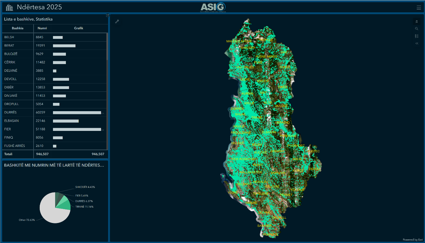
“Buildings 2025” is a digital and interactive thematic map, which presents the updated inventory of buildings in the territory of the Republic of Albania.
- The system provides information on the geographical distribution, features and surfaces of buildings in all municipalities of the country.
- The data are available in the form of a Web Map and an interactive analytical Dashboard on the ArcGIS Online platform, which provides user institutions with immediate access, dynamic visualization, spatial analysis and informed decision-making on the urban, rural and economic development of the country.
The importance of the vector layer, “Buildings 2025”:
✅Supports territorial and urban planning.
✅ Helps in the management of infrastructure and public services.
✅ Facilitates the processes of legalization, registration and monitoring of buildings.
✅ Used for socio-economic and demographic analyses.
✅ Increases institutional security during emergency responses.