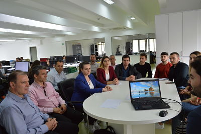
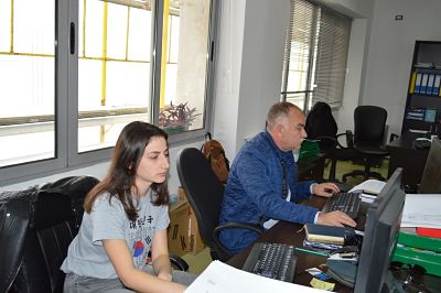
Students of the Faculty of History and Philology, visit ASIG
Professors and students of the University of Tirana, Faculty of History and Philology, Department of Geography, in the program of Master Professional Study (GIS applied), visited the premises of the State Authority for Geospatial Information (ASIG).
The General Director of ASIG Lorenc Çala, after thanking them for the visit, acquainted them with ASIG’s role and responsibilities in the creation of NSDI in Albania, as well as in his speech Mr.Çala emphasized the necessity of cooperation with the academic world today to bring skilled professionals in the field of geoinformation, which is so much in need in the business world today.
The director of the Geodesy and Cartography directorate, presented the students with the projects of this directorate on the construction of the National Geodetic Reference Framework (KRGJSH) and Basic Map of Albania.
While the director of the National GIS and Geoportal directorate, presented the data and services that ASIG offers in the National Geoportal, he also acquainted the students with the role and responsibilities of ASIG in drafting and implementing the standards under the INSPIRE directive as well as on the role and responsibilities of Public Authorities in collecting, processing and updating geospatial information.
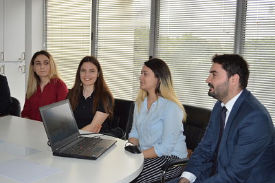
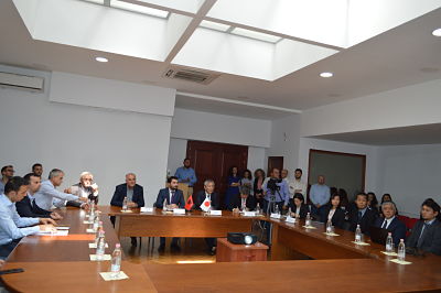
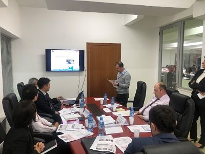
Meeting on the project “Geospatial information and sustainable land development in Tirana-Durres area” with JICA
Under the organization of JICA (Japan International Cooperation Agency), the meeting on the progress of the project “Geospatial information and sustainable land development in Tirana-Durres Area “, was held on 23.05.2019, at the premises of the Europa Hall. In this meeting were present, his excellency Ambassador of Japan, Makoto Ito, chief representative of JICA Balkan office, staff of the State Authority for Geospatial Information (ASIG), and professors and students of the Polytechnic University of Tirana from Geodesy Department.
The purpose of this meeting was to present the progress of ASIG’s project with JICA as well as the experience that ASIG students’ practitioners are receiving from this cooperation in providing basic knowledge in the field of cartography, photogrammetry and the use of contemporary technologies in the field of geoinformation.
In his greeting speech, General Director of ASIG, Lorenc Çala thanked the JICA team for the work done so far with this project, listed some finalized accomplishments by this cooperation, and highlight the necessity of exchanging experiences such as this, with the Japanese government, not only for the ASIG institution, but also for the academic field and the new generation of students in geodesy.
His Excellency Ambassador of Japan, Makoto Ito, in his speech praised the support that the Japanese government has given and will give to Albania, congratulated both JICA and ASIG teams for the work done regarding the project in question as well as the importance of creating opportunities for practical experience for graduated students.
At this meeting also greeted representatives of the Polytechnic University of Tirana as well as students of this university, who through a presentation showed their experience earned during the ASIG learning practice with the JICA team.
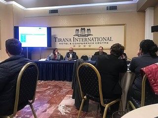
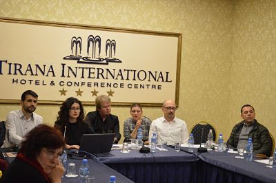
Workshop on the topic, “Mapping of the Risk Assessment from Disasters”
In the workshop on the topic “Mapping Risk Assessment from Disasters,” organized within the framework of the IPA-DRAM program on April 23-24, 2019, at the premises of Hotel Tirana International, specialists from the State Authority for Geospatial Information (ASIG) in the Geoinformation Standards sector also participated.
The aim of this project is the establishment of effective, coherent, and EU-oriented national systems for data collection, losses in natural disasters, risk assessment and mapping, as well as the extension and integration into the civil protection mechanism of the European Union.
This workshop focused on:
• Reviewing and developing 3 scenarios for floods, earthquakes, and fires.
• Discussing and consolidating scenarios for NDRA (National Disaster Risk Assessment).
• Determining mitigating measures related to the identified scenarios outlined in the OSCE 2016 study.
• Steps for the preparation of the formal document, NDRA.
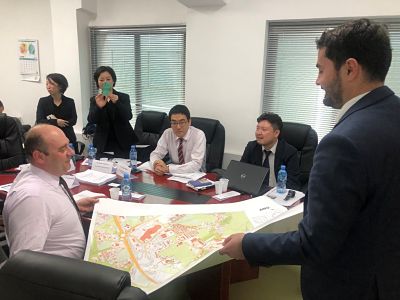
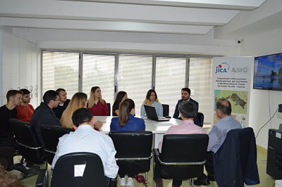
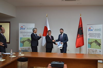
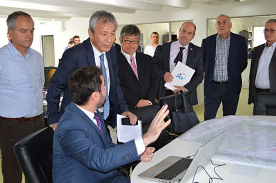
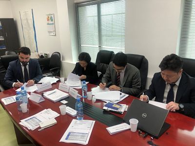
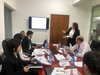
The Coordinating Committee of the project with JICA meets
In the premises of the State Authority for Geospatial Information (ASIG), the Coordinating Committee gathered on April 11, 2019, within the framework of the project titled: “Geospatial Information for Sustainable Land Development in the Tirana-Durrës Region.”
This meeting was conducted under the direction of Mr. Lorenc Çala, General Director of ASIG, and in the presence of a representative from the Prime Minister’s Office, representatives from the Embassy of Japan, representatives from the Japan International Cooperation Agency (JICA), as well as teams from the ASIG and JICA project.
During this meeting, the main objectives of the project were presented, its current progress was discussed, the future work plan was examined, and ideas were exchanged regarding various issues, culminating in the approval of the interim report.

Participation in the Conference ‘Faster, Smarter, Safer
Specialists from the State Authority for Geospatial Information (ASIG), from the National GIS and Geoportal Directorate, participated in the conference “Faster, Smarter, Safer” held on April 2, 2019, at the Hilton Garden Inn, organized by InfoSoft Systems in collaboration with Cisco and F5.
The main issues addressed at this conference were:
1. Introduction to “F5 Networking & InfoSoft Systems.”.
2. “Why application security is new must, F5 Networks”.
3. “Security’s new frontier- The Cloud”.
Employment of the Excellent Students and Work Practices at ASIG
Based on Decision No. 766, dated 26/12/2018, point 4, of the Council of Ministers, “On the employment of excellent students in institutions of the state administration, part of the civil service, for the year 2019,” the Department of Public Administration announced the procedures for expressing interest in the employment of excellent students in specialist and equivalent positions in state administration institutions, part of the civil service, specifically at the State Authority for Geospatial Information (ASIG). Five vacant positions were published.
At the conclusion of this process, for the vacant positions, student Xhesian Balili has been announced as the winner and appointed to the position of specialist in the National GIS Sector, in the Directorate of National GIS and Geoportal, at ASIG.
Additionally, based on Decision No. 395 of the Council of Ministers, dated 29.04.2015, “On the approval of the national program of work internships in the state administration and other public institutions,” amended, and the fourth call of the National Internship Program, ASIG, after completing the assessment process for interested candidates, qualified three winners who have signed agreements for the development of their internship at ASIG.
This program aims to provide opportunities for enhancing their expressions in getting acquainted with the public administrative system, through the practical application of theoretical knowledge gained during their studies, developing professional skills, and orienting towards the job market. The duration of the National Internship Program is three months.
Participation in the final workshop of the SPATIAL project
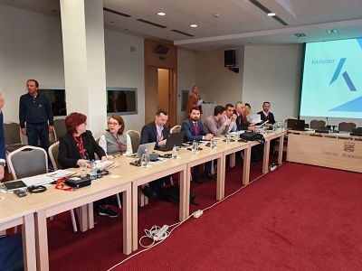
Leaders from the State Authority for Geospatial Information (ASIG) participated in the concluding meeting of the SPATIAL project held on March 12-13, 2019, in Podgorica, Montenegro. This meeting was organized as part of the project “Strengthening Professional Access to Inform Land (SPATIAL) in the Western Balkans,” which is part of the pre-accession program to the EU.
The theme of this workshop was “Future Collaboration and Strategic Planning,” aiming to share experiences in strategic planning and discuss future collaboration between the Netherlands and the Western Balkans region regarding land information issues.
The project aims to strengthen relationships between public institutions regarding cartography, land registry, and cadastre, as well as to bring Dutch expertise in these fields to the region.
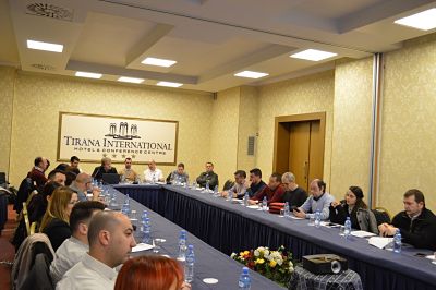
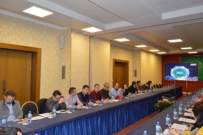
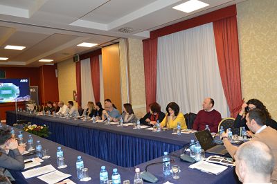
Workshop on standardization and harmonization of geospatial data
The State Authority for Geospatial Information (ASIG), in collaboration with the IMPULS project, organized a workshop on February 28, 2019, at the premises of Hotel Tirana International with the theme: “Standardization and harmonization of geospatial data.”
Representatives from responsible public authorities for the topics of Article 11 of Law No. 72/2012, “On the organization and functioning of the National Infrastructure of Geospatial Information in the Republic of Albania,” participated in this workshop. The aim of this workshop was to assist these authorities in harmonizing geospatial data according to the developed standard.
Swedish and Croatian experts from the IMPULS project presented the INSPIRE standards for harmonizing geospatial data, emphasizing the importance of this process for creating the NSDI (National Spatial Data Infrastructure). They also shared the achievements and experiences of their agencies, which play the coordinating authority role in Sweden and Croatia.
ASIG experts demonstrated the data harmonization process for the themes “Geographical Names” and “Hydrography” using various software tools during this workshop.
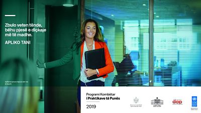
CALL #4: NATIONAL INTERNSHIP PROGRAM
Based on the decision of the Council of Ministers no. 395, dated 29.04.2015, “On the approval of the national program of work practices in the state administration and other public institutions,” amended, the Ministry of Education, Sports, and Youth announces the opening of the fourth call for the National Internship Program.
The application deadline is from February 8 to February 28, 2019.
The application is open to young professionals aged 21 to 26 who hold at least a Bachelor’s degree or equivalent.
The duration of the National Internship Program will be three months.
Details about the required profiles, the number of placements, and other information can be found on the dedicated link: http://praktika.arsimi.gov.al/. http://praktika.arsimi.gov.al/.
Participants will engage in an integrated work experience and interaction with career professionals in public administration, aiming to gain a qualifying experience that contributes to the development of their professional skills and practical expressions.
Dokumentet për aplikim:
a- CV
b-Diploma of completion of higher education studies;
c-Grade list;
d-A motivational letter
The application will be submitted online at the following link:
http://praktika.arsimi.gov.al/.

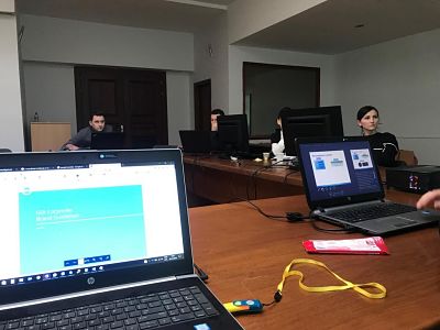
Professional training for ArcGIS Pro
In the training organized in the Europa Hall from January 9th to 11th, 2019, by GDi Albania, with funding from JICA (Japan International Cooperation Agency), within the framework of the project that ASIG (State Authority for Geospatial Information) has with this agency, representatives from the National GIS Sector and the Cartography Sector of the State Authority for Geospatial Information participated.
This training focused on acquiring skills in using the ArcGIS Pro software, which is crucial in the activities of these sectors.