The State Authority for Geospatial Information (ASIG), mandated by Law no. 72/2012, “On the organization and functioning of the national infrastructure of geospatial information in the Republic of Albania,” as the authority responsible for creating and maintaining the Albanian Geodetic Reference Frame, has developed the project for the Tide Gauge Network in the Republic of Albania.
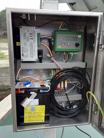
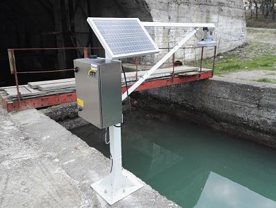
In fulfilling this task, ASIG has initiated the implementation of this project by commissioning the Tide Gauge in Kepi i Palit (Durrës), ending a 25-year absence of information on sea level monitoring. This project is being implemented with Norwegian assistance through the ALNO-HIP project, which aims to build two tide gauge stations in Durrës and Sarandë. It is expected that the Sarandë station will be operational by April of this year. ASIG also plans, with the funds made available by the Albanian government, to construct and install two additional tide gauge stations (Shëngjin and Orikum). All these efforts are part of the realization of the national project for geodetic networks. These stations will fill a long-standing gap in data on sea level along the Albanian coastline, crucial as a baseline for creating the Albanian Geodetic Reference. The data generated, analyzed, and published will meet the requirements of various agencies: state institutions, local authorities, and international entities involved in studying the dynamics of the Albanian coastline. The data from the tide gauges installed along the coastline will be transmitted through an online communication line from the stations to the control center at ASIG. Subsequently, this data will undergo relevant processing and analysis to calculate the average sea level, LAT, etc., which will be published through a dedicated service on the official ASIG website.