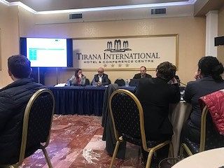
In the workshop on the topic “Mapping Risk Assessment from Disasters,” organized within the framework of the IPA-DRAM program on April 23-24, 2019, at the premises of Hotel Tirana International, specialists from the State Authority for Geospatial Information (ASIG) in the Geoinformation Standards sector also participated.
The aim of this project is the establishment of effective, coherent, and EU-oriented national systems for data collection, losses in natural disasters, risk assessment and mapping, as well as the extension and integration into the civil protection mechanism of the European Union.
This workshop focused on:
• Reviewing and developing 3 scenarios for floods, earthquakes, and fires.
• Discussing and consolidating scenarios for NDRA (National Disaster Risk Assessment).
• Determining mitigating measures related to the identified scenarios outlined in the OSCE 2016 study.
• Steps for the preparation of the formal document, NDRA.