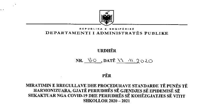
Order no. 80, dated 17.11.2020
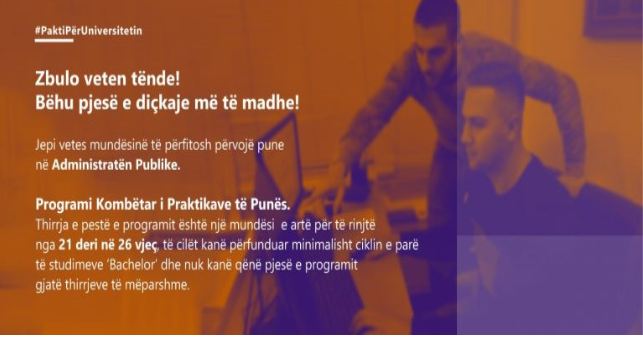
CALL #5: NATIONAL INTERNSHIP PROGRAM.
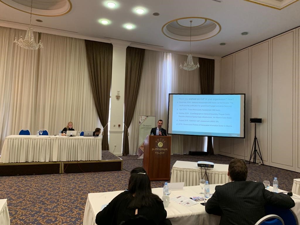
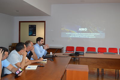
ASIG participates in the launch of the SPATIAL II project
Representatives of the State Authority for Geospatial Information (ASIG), in leading roles, participated in the event organized by the “Land Registry and Mapping Agency” of the Netherlands’ Cadastre, on February 05-07, in Skopje, North Macedonia, within the framework of the project “Strengthening Professional Access to Land Information,” SPATIAL II “in the Western Balkans region.
The purpose of this project is to improve the capacities of the Cadastral and Cartographic Agencies in the Western Balkans region in order to provide institutions and the public with reliable land information.
ASIG representatives presented in this event an informative material on the use of the UN-GGIM policy paper “Integrated Geospatial Information Framwework” in the development of the project “Reforming the Geoinformation Sector in the Republic of Albania.
ASIG participates in the conference of concluding the IPA DRAM program
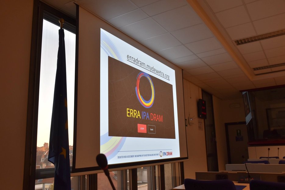
The IPA DRAM Consortium, “Disaster Risk Assessment and Mapping”, organized the final conference on November 19, 2019, and the meeting of the IPA DRAM Steering Committee on November 20, 2019, in Brussels, Belgium. This program aims at supporting disaster risk management in order to ensure its proper management at national level for Southeast European countries such as Albania, Bosnia and Herzegovina, Northern Macedonia, Kosovo, Montenegro, Serbia and Turkey.
The State Authority for Geospatial Information (ASIG) was represented at the event as the central institution involved in this program, with Mr. Dritan Prifti, responsible for the “Remote Sensing” sector who participated in the Electronic Regional Risk Atlas (ERRA) panel where he presented Albania’s contribution as a good practice of incorporating National Geospatial Data Infrastructure in support of protection activities. civil, as well as synergies between regional projects, IPA DRAM and the IMPULS project.
The main purpose of the conference was to present the achievements and results of the IPA DRAM program partners, exchange experiences and discuss how the results of the program can be used.
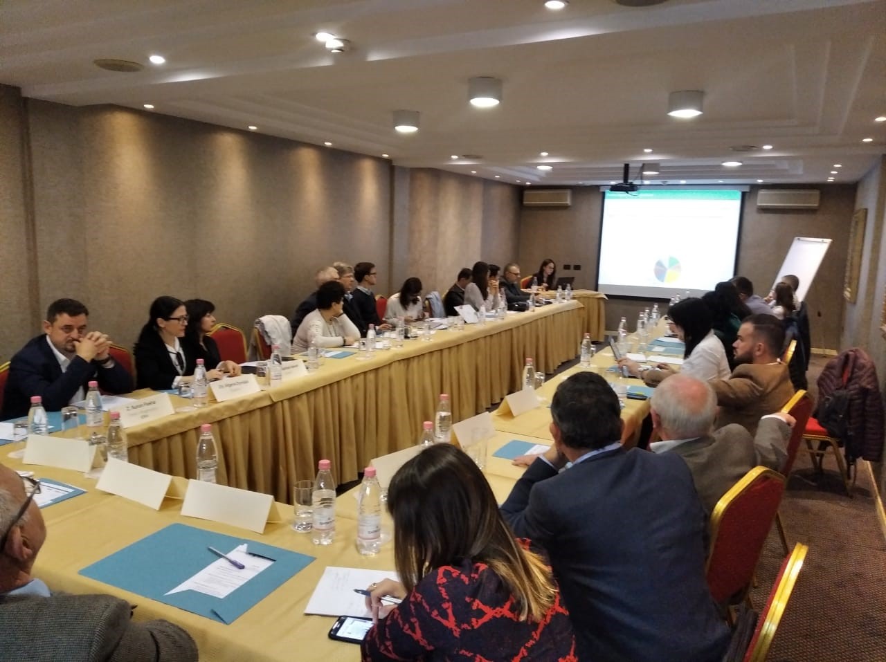
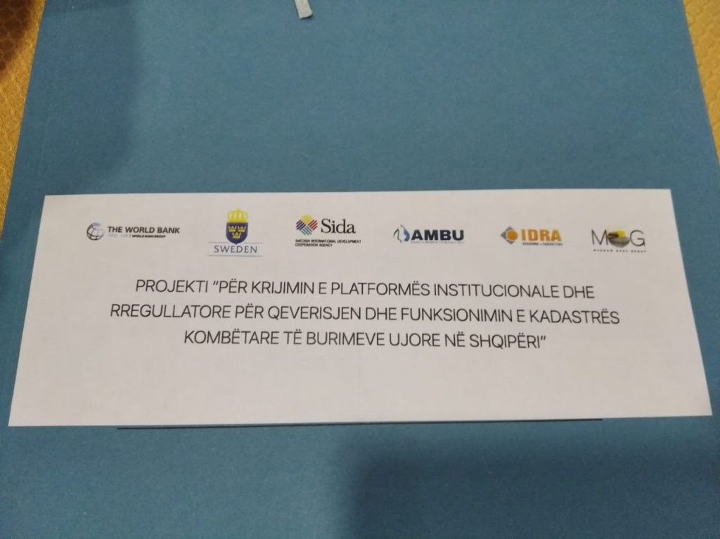
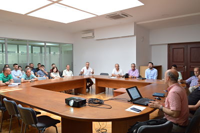
ASIG participates in the workshop organized for the National Water Resources Cadastre in Albania
AMBU Water Resources Management Agency organized on November 15, 2019, at the Grand Hotel, Tirana, the workshop within the framework of the project “Creating an Institutional and Regulatory Platform for the Governance and Functioning of the National Water Resources Cadastre in Albania”. including representatives of the State Authority for Geospatial Information from the Geo-information Standards sector and the National GIS sector.
This workshop focused mainly on presenting a summary of the project implementation of the National Water Resources Cadastre in Albania, as well as presenting the current work and further steps highlighting the deficiencies and the current state of measuring infrastructure for water resources in the Republic of Albania.
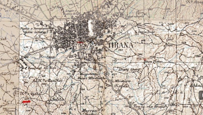
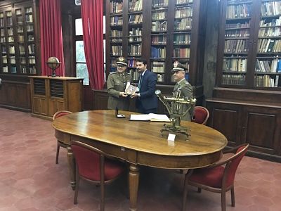
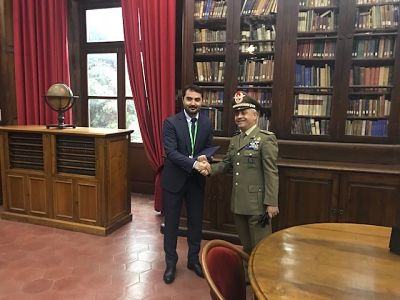
Visit to the premises of the Military Geographic Institute of Florence
Representatives of the State Authority for Geospatial Information (ASIG) visited the premises of the Military Geographic Institute of Florence, where they were introduced to the history of this institution from the moment of creation, the materials it possesses, and the techniques of its work. The purpose of the ASIG’s visit was interest, in getting to know and enable the acquisition of mappage and aerial photographs for the Republic of Albania, created over the years, starting in 1928. Once in possession of these materials, will be published in the National Geoportal and will be available for institutions and the public.
It is worth mentioning that the Italian Military Geographic Institute (IMGI) is the geographical support office of the Italian Army.
This institute is also a National Cartographic Authority and therefore the cartography produced by it is of high quality, used by public and private entities and is considered, official state cartography.
The Military Geographic Institute of Florence also has a museum with collections of instruments used for carrying out works of astronomy, geodesy, topography, photogrammetry and calculations.

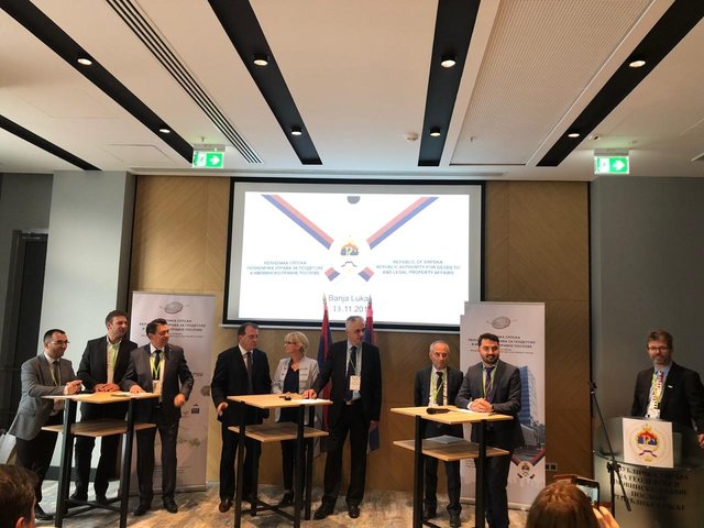
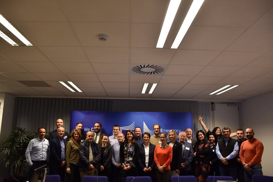
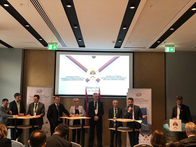
ASIG participates in the closing event of the IMPULS project
Representatives of the State Authority for Geospatial Information (ASIG), chaired by the general director Loren Çala attended the closing event of the IMPULS project, which took place on November 13, 2019, in Banja Luka, Bosnie Herzegovina.
The purpose of this conference was to present the main achievements and results of the IMPULS project by the regional coordinators and leaders of the institutions responsible for cartography and cadastre from the Western Balkan countries, respectively from Kosovo, Albania, Northern Macedonia, Montenegro, Bosnie Herzegovina. Herzegovina, Serbia, Slovenia and Croatia.
The main objectives of the project were:
·Implementation the INSPIRE Directive in the Western Balkans region by helping the beneficiary countries meet EU requirements in the field of geoinformation as well as contributing to economic development, transparency and the fight against corruption.
· Contribution of the geo-information sector through the interaction of data and services, to the development of E-Government of participating states at central and local level.

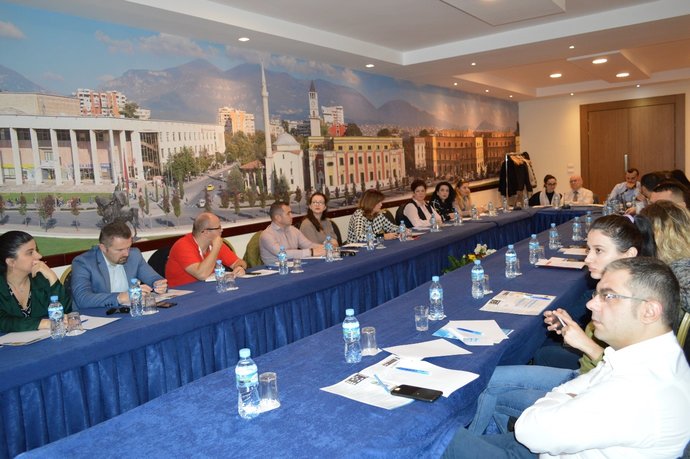
Workshop on data sharing of geospatial data and services
The State Authority for Geospatial Information (ASIG), in cooperation with the IMPULS project, organized on 20.11.2019, in the premises of Hotel Tirana International the workshop: “Data sharing of geospatial data and services” This workshop was attended by representatives of the public authorities responsible for the theme of Article 11 of Law No. 72/2012 “For the organization and operation of the national infrastructure of geospatial information in the Republic of Albania ” and the expert of the swedish cartographic authority “Lantmateriet” ”, Mr. Gunnar Lysell, representative IMPULS project. ASIG experts in this workshop presented;
• By-laws adopted on uniform rules for geospatial information infrastructure and the exchange of geospatial data and services between public authorities.
• The National GIS Project and the steps taken by ASIG to implement this project.
• Exchange of geospatial data and services through the National Geoportal and live demonstration of this exchange.
In this workshop the Swedish expert presented models on licensing and copyright for geospatial data, their charging and swedish experience in geospatial information exchange.
Participants from the public authorities praised ASIG’s achievements in establishing a national geospatial information infrastructure and providing assistance to public authorities.
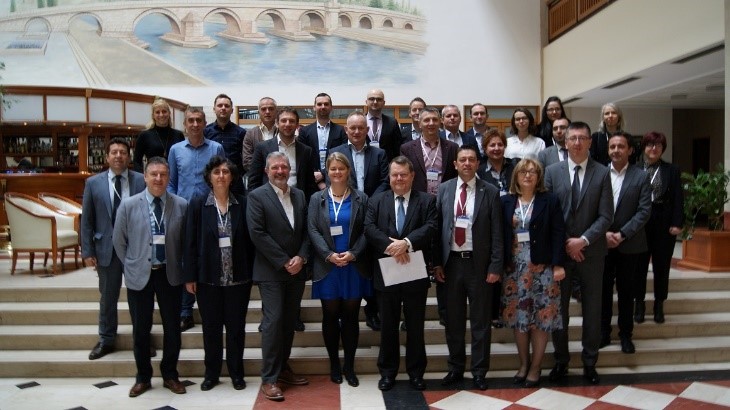
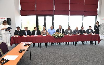
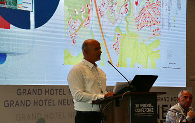
ASIG attends XII Regional Conference on Geospatial Information Cadastre and Infrastructure
Representatives of the State Authority for Geospatial Information (ASIG), chaired by General Director mr. Lorenc Çala attended the 12th Regional Conference on Geospatial Information Cadastre and Infrastructure in the Western Balkans which was held on September 5 and 6, 2019, in Neum, Bosnie-Herzegovina.
The main purpose of this conference was to sign an agreement of cooperation and understanding between the institutions responsible for cartography and cadastre from the countries of the Western Balkans, namely Kosovo, Albania, the Republic of Northern Macedonia, Montenegro, Bosnie-Herzegovina, Serbia, Slovenia and Croatia.
This agreement aims to increase the level of cooperation between the respective institutions in the areas of common interest, including advancing cooperation in cadastre, geodesy and mapping, developing and interacting GNSS systems, developing gravimetric and trigonometric networks, harmonizing and opening up of geospatial data in line with EU policies and directives.
This agreement was also supported by authorities in the field of cartography and cadastre in Sweden, Norway, the Netherlands, as well as international organizations, the World Bank and JICA, which were also promoters of reaching this agreement.
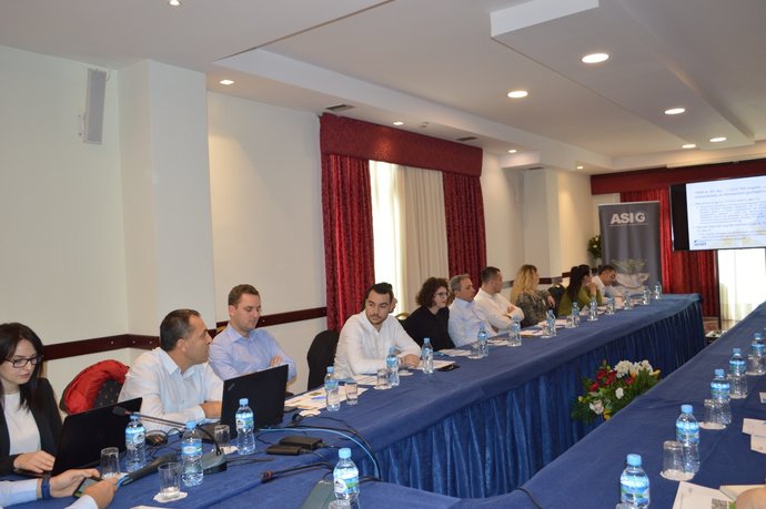
Workshop on “BESTSDI Albania”
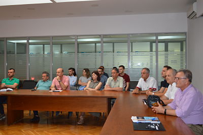
The State Authority for Geospatial Information (ASIG), in collaboration with the Faculty of Civil Engineering (FIN), organized a workshop on July 3, 2019, at the ASIG premises, in the “Europe” hall, with the theme “BESTSDI Albania.” The workshop was attended by ASIG officials as well as students and faculty members from the Department of Geodesy at the Faculty of Civil Engineering (FIN).
The purpose of this workshop was to highlight the steps taken towards the establishment of the National Spatial Data Infrastructure (NSDI) in the Republic of Albania, within the framework of implementing the INSPIRE directive. Additionally, it aimed to emphasize the use of geospatial data and services by professionals in the field and geodesy students.
ASIG’s General Director, Mr. Lorenc Çala, in his presentation, provided an overview of the steps and achievements of ASIG in establishing NSDI based on the rules and standards of the INSPIRE directive. He emphasized the need for further development in the geoinformation field based on user needs. To enable the tracking of technological developments, the importance of adapting study curricula for the geoinformation field was highlighted.
Leaders of ASIG presented key topics on Spatial Data Infrastructure (SDI), the National Geoportal, and the provision of its services in accordance with INSPIRE standards. The presentation covered data modeling based on approved standards, harmonization of existing data, and collaboration with projects funded by foreign donors. Special emphasis was given to the role and assistance of the IMPULS project in building the National Geospatial Information Infrastructure in Albania.